Executive Summary
An underwater tracking device — also called an underwater detection or positioning system — is any instrument that tells an operator where a submerged object is. GPS cannot do that job: radio signals are absorbed within centimeters of the water surface. Every working solution is therefore built from acoustics plus dead-reckoning sensors, arranged in four layers: acoustic positioning (USBL or LBL), underwater GPS, inertial navigation, and the layer most new buyers overlook — a Doppler Velocity Log (DVL). The DVL measures true velocity over the seabed 5–10 times per second, holding the position estimate together between sparse acoustic fixes. This guide explains each layer, compares the main device types, and shows exactly where a DVL fits into a professional tracking stack. Explore the Oceantek DVL line →
Table of Contents
Why GPS Stops Working Underwater
GPS depends on L-band radio signals at roughly 1.2–1.6 GHz — and water is almost opaque to them. The signal attenuates so fast that a receiver sealed in a waterproof housing loses its fix within centimeters of submergence. This is a physics problem, not an engineering one: no antenna design will fix it. (If you have ever put a phone in a dry bag and watched the position freeze, you have seen the effect firsthand.)
Sound behaves completely differently. Acoustic waves travel through seawater at about 1,500 m/s, over ranges from hundreds of meters to several kilometers depending on frequency. That is why every underwater tracking device on the market is acoustic at its core — the industry simply has no other practical carrier for positioning signals below the surface.
This does not mean surface GPS is irrelevant to underwater tracking. It is the reference origin of the whole system: a USBL transceiver or an underwater GPS topside unit knows its own satellite-derived position, then converts acoustic range and bearing measurements into absolute coordinates for the submerged target. GPS anchors the stack; acoustics extends it downward.
How Underwater Tracking Devices Work: The Four-Layer Stack
Every professional underwater navigation system — from a $4,000 inspection-ROV kit to a deep-water survey spread — is a combination of four layers. None of them is sufficient alone. The accuracy of the whole system comes from how they are fused: sparse absolute fixes from acoustics, held together by high-rate velocity and motion data from the dead-reckoning layers.
Layer 1: Acoustic Positioning — USBL, LBL, SBL and GIB
Acoustic positioning is the only way to get an absolute position fix underwater, and it works like an inverted sonar conversation. A USBL (Ultra-Short BaseLine) transceiver mounted on a surface vessel sends an acoustic pulse to a transponder on the target; the transponder replies; the transceiver measures the two-way travel time for range and the phase difference across its hydrophone array for bearing. One surface unit can therefore track multiple targets — divers, ROVs, AUVs or towfish — in sequence.
A good reference point is Sonardyne’s Micro-Ranger 2, a self-contained portable USBL that tracks up to 10 targets at ranges up to about 995 m with accuracy up to 5% of slant range; its larger vessel-based sibling, Scout Plus, extends coverage to the 1,000 m depth class. These numbers illustrate the fundamental trade-off of this underwater acoustic sensor family: good range and multi-target capability, but accuracy that scales with distance and an update rate that rarely exceeds 1–2 Hz.
Where projects need centimeter-level accuracy over long periods, teams deploy LBL (Long BaseLine) networks: a field of fixed transponders on the seabed, surveyed into known positions, which a vehicle interrogates to triangulate its location. LBL is the gold standard for accuracy, but the array is expensive to deploy, survey and recover. SBL (Short BaseLine) systems use a spread of hydrophones across the hull instead of the seabed, and GIB (GPS Intelligent Buoy) systems put GPS-synchronized hydrophones on floating buoys that listen for a pinger on the target — useful where a dedicated survey vessel is impractical.
Layer 2: Underwater GPS
“Underwater GPS” is the marketing name for a family of acoustic positioning systems designed to feel like GPS for a pilot: a topside unit with a GNSS antenna and four transducers triangulates acoustic pings from a battery-powered locator mounted on the vehicle, adds a pressure-sensor depth, and renders the result as a live position on a chart. Water Linked’s Underwater GPS G2, the best-known example, offers 100 m and 300 m range configurations with a ping rate of roughly 2–4 Hz.
The appeal is real: unlike USBL, the position is drift-free and global, with no slant-range accuracy penalty, and deployment takes minutes rather than a calibration dive. The limits are equally real: range is tied to the small baseline of the topside array, so gps underwater positioning works best for inspection ROVs working within a few hundred meters of the surface unit — not for long AUV transects. For a deeper dive into how these systems work, read our full explainer: Underwater GPS Explained: How Positioning Works Below the Surface.
Layer 3: Inertial Navigation — INS and IMU
An IMU (Inertial Measurement Unit) — gyroscopes plus accelerometers — measures orientation and acceleration at 100+ Hz, and an INS (Inertial Navigation System) integrates those measurements into a continuous position estimate. Because INS needs no external signal, it works everywhere: under ice, inside pipelines, in the shadow of a hull. It is the always-on backbone of every tracking stack.
The catch is drift. Every tiny sensor error accumulates through double integration, so a position estimate degrades over time and can grow without bound if nothing corrects it. That is why navigation discipline matters as much as hardware: experienced operators re-reference the estimate after every course change, every speed change and every external acoustic fix. For a full treatment of how vehicles navigate when satellites are unavailable, see AUV Navigation Without GPS: How Dead Reckoning Actually Works.
Layer 4: The Doppler Velocity Log (DVL) — The Layer Most Buyers Miss
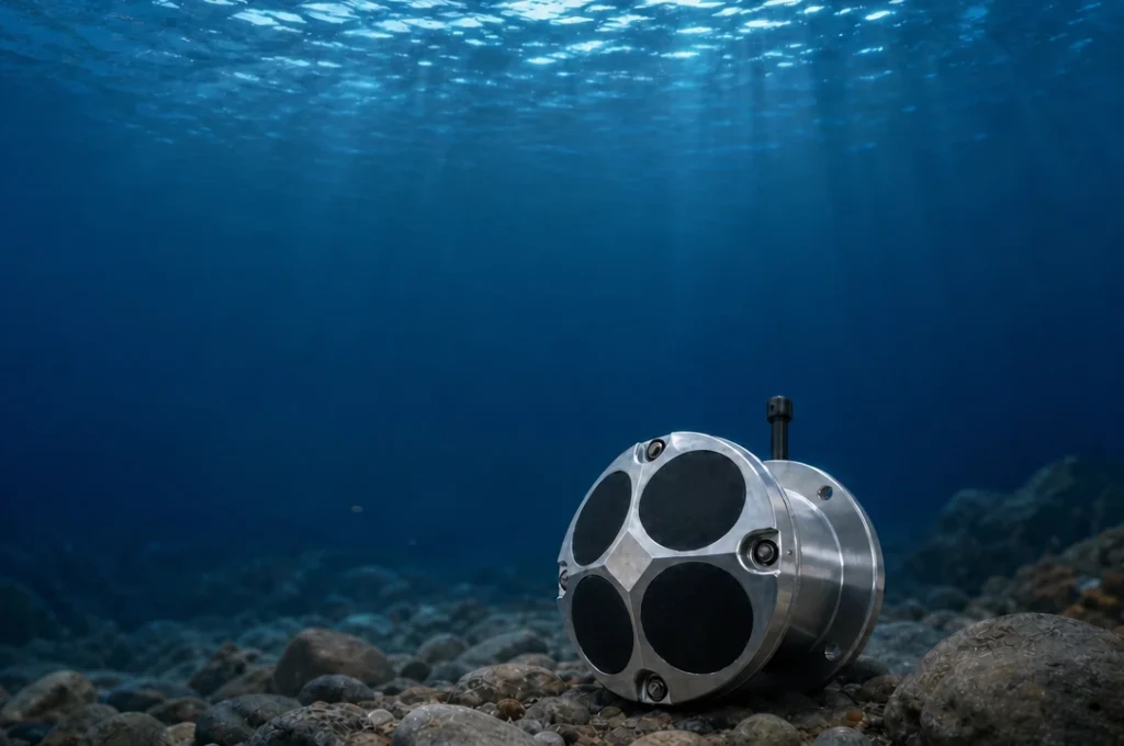
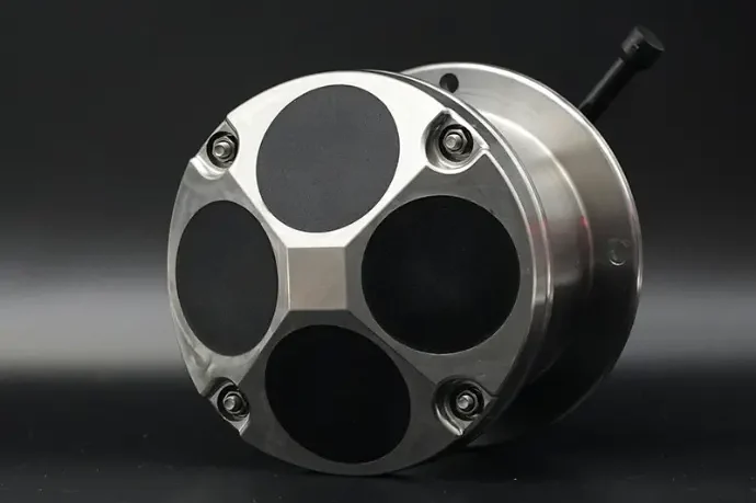
A DVL is an acoustic sensor that measures a vehicle’s velocity relative to the seabed. It transmits four (or five) beams in a Janus configuration, measures the Doppler shift of each echo, and computes a three-axis velocity vector — then integrates that velocity into position. Modern units update at 5–10 Hz, which is an order of magnitude faster than any acoustic positioning fix.
That speed difference is why the DVL matters in a tracking stack. Between two USBL fixes a second or more apart, the vehicle can drift meters. The DVL is what fills that gap, and it is also the sensor that suppresses INS drift: its velocity is fed directly into the navigation filter, typically over standard PD0/PD6 output formats that every major INS accepts. When the seabed is out of range or the bottom-track quality degrades, good units fall back to water-track mode using suspended particles in the water column, and they output altitude as a bonus channel for terrain following.
Oceantek builds three DVLs that cover the spread of subsea platforms (full comparison here):
- DVL-600-FA4 — 600 kHz, 4-beam piston/Janus transducer, ±0.3% ±3 mm/s accuracy, 110 m bottom-lock. The standard choice for AUV survey and work-class ROV navigation.
- DVL-600-PA5 — 600 kHz phased-array with 5 beams in a Φ92 × 112 mm package weighing ≤1.8 kg and drawing ≤5 W. Built for compact inspection ROVs and small platforms.
- DVL-300-FA4 — 300 kHz, 4 beams, ±0.5% ±5 mm/s, 220 m bottom-lock for deep-water work. Titanium housing with depth ratings of 1,000 / 3,000 / 6,000 m.
For the physics of how a DVL turns acoustic pulses into a velocity vector, start with How a Doppler Velocity Log (DVL) Works: From Acoustic Pulse to Velocity Vector, and for the bottom-track vs water-track decision, see Bottom Tracking vs Water Tracking in DVL.
Types of Underwater Tracking Devices Compared
Here is the full landscape of device types in one view. Note that no single vendor builds every row of this table — a complete tracking stack typically mixes two or three suppliers, and that is normal practice.
| Device Type | What It Does | Update Rate | Typical Range | Best For |
|---|---|---|---|---|
| USBL transceiver + transponder | Measures range and bearing from a vessel-mounted transceiver to a transponder on the target | 0.5–2 Hz | Up to ~1,000 m (portable systems) | Tracking divers, ROVs, AUVs and towfish from a support vessel |
| LBL transponder network | Fixed seabed transponders that a vehicle interrogates to triangulate position | 0.1–1 Hz | Kilometer-scale arrays | Long-duration site work needing centimeter-level accuracy |
| Underwater GPS (UGPS) | Topside antenna triangulates acoustic pings from a locator on the vehicle | ~2–4 Hz | 100–300 m (typical) | Drift-free, chart-style position display for inspection ROVs |
| Acoustic beacon / release | Battery-powered pinger or responder for locating assets or triggering mooring releases | Event-driven | 1–8 km (pinger class) | Asset relocation, recovery, scientific tagging |
| Doppler Velocity Log (DVL) | Measures vehicle velocity over the seabed for dead reckoning and INS aiding | 5–10 Hz | 110–220 m bottom-lock | Continuous velocity between acoustic fixes; drift suppression |
| INS / IMU | Gyroscopes and accelerometers track orientation and acceleration | 100+ Hz | n/a | Orientation and high-rate motion data in all conditions |
| Depth sensor | Pressure-based vertical reference | 10–50 Hz | Full operating depth | The vertical axis for every system above |
Why a DVL Belongs in Every Tracking Stack
Here is the uncomfortable truth about acoustic positioning: your absolute fixes arrive once or twice per second at best, and sometimes not at all. Under a ship’s hull, beside a quay wall, in shallow water with heavy multi-path, or during a survey leg where the USBL beam is shadowed — the fix stream simply stops. Meanwhile the INS keeps integrating, its error growing with every silent second. When the next fix finally arrives, the navigation filter has to swallow a jump, or the operator is left flying on an estimate that has quietly gone stale.
The DVL is the cheap, continuous layer that removes this problem. At 5–10 Hz it is always measuring true seabed-relative velocity, so:
- Between fixes, position advances on measured velocity rather than on hope — a 5-second USBL gap costs centimeters of error instead of meters.
- During station-keeping, the vehicle can hold position with a velocity feedback loop that does not depend on the acoustic link at all.
- Inside the navigation filter, DVL velocity bounds INS drift over long transects, which is exactly why deep-water AUV missions pair sparse acoustic updates with continuous DVL input.
The market has already settled this question. Cerulean sells its ROV Locator USBL kits alongside the Tracker 650 DVL (675 kHz, 300 m rated, 5–20 Hz output) precisely because pilots wanted continuous tracking between pings. Water Linked sells DVLs next to its Underwater GPS with documented fusion workflows in the same software stack. Tracking system designers on all sides have converged on the same architecture: acoustic layer for absolute position, DVL layer for continuity.
Budget is rarely an objection. Compact DVLs sit in the $2–5K band — less, in many operations, than a single day of vessel time — while mid-range USBL systems start in the $5–10K band and professional spreads run higher. For the price of a few percent of the total tracking budget, the DVL buys the difference between a position that jumps and a position that flows.
Underwater Tracking by Application
Different missions lean on different layers of the stack. Here is how the architecture usually breaks down:
| Scenario | Typical Stack | Read Next |
|---|---|---|
| Work-class ROV operations — subsea construction, IRM, station-keeping | USBL + DVL + INS, with surface GPS anchoring the transceiver | AUV & ROV Underwater Positioning: Can an Oceantek DVL Solve the Challenge? |
| AUV survey and inspection — pipeline, bathymetry, geophysical transects | DVL + INS as primary, sparse LBL/USBL as correction | Primary Applications of DVL — and if you are comparing options for the best DVL for autonomous underwater vehicles, the 600 kHz class with ±0.3% ±3 mm/s accuracy is the reference point. |
| Inspection ROV piloting — hull and port surveys within a few hundred meters | Underwater GPS + DVL + depth | See the underwater GPS explainer linked in Layer 2 above. |
| Diver operations — safety supervision, search | USBL (DiveTrack-class) + depth tags | — |
| Subsea asset location — pipelines, dropped tools, mooring recovery | Acoustic beacons / LBL arrays | — |
How to Choose an Underwater Tracking Device: 6 Questions to Ask
Before you compare quotes, answer these six questions — they define which layers you need and in what size.
- What range and depth do you actually work at? A 100 m UGPS kit cannot stretch to a 500 m survey spread, and a deep-water LBL array is overkill for harbor inspection. Work from your real operating envelope, not your ambitions. Our DVL Buyer’s Guide for AUV/ROV maps vehicle classes to sensor classes the same way.
- How often do you need a position update? If anything in your loop — pilot, autopilot or data logger — needs 5+ Hz, an acoustic-only system cannot deliver it. You need a DVL in the stack.
- Does it have to feed an INS? If yes, check the interface before anything else: standard PD0/PD6 output means plug-and-play with the major navigation filters; proprietary formats mean integration engineering.
- What can your platform carry? Small inspection ROVs have tight power and buoyancy budgets — a phased-array DVL like the DVL-600-PA5 (≤5 W, ≤1.8 kg) exists precisely for this constraint.
- What is your budget band? Rough 2026 bands: compact locators and DVLs $2–5K, mid-range USBL and UGPS $5–10K, professional USBL/INS spreads $10K+. How to Buy a DVL explains what sits behind the DVL price tag.
- Who supports you after delivery? A tracking stack only works when the vendor answers integration questions quickly. Check lead times, firmware updates and whether the support team understands your platform.
FAQ
Does GPS work underwater?
No. GPS relies on L-band radio signals that water absorbs within centimeters of the surface. Underwater tracking devices therefore use acoustic signals, which travel at roughly 1,500 m/s in seawater. Products marketed as “underwater GPS” use acoustic triangulation, not satellite signals.
What is the difference between USBL and underwater GPS?
Both are acoustic, but they measure differently. A USBL transceiver on a surface vessel measures range and bearing to a transponder on the target using a hydrophone array. An underwater GPS system triangulates pings from a vehicle-mounted locator using a topside antenna with four transducers. Underwater GPS is typically simpler to deploy and drift-free; USBL covers longer ranges and more targets. Read the full underwater GPS explainer →
How accurate are underwater tracking devices?
It depends on the technology. LBL transponder networks can reach centimeter-level accuracy. USBL systems typically achieve 0.1–5% of slant range, and underwater GPS systems around 1% of range. Between acoustic fixes, a DVL holds velocity accuracy of ±0.3% ±3 mm/s, which keeps the position estimate from drifting between updates.
Can you track an ROV without a surface vessel?
Yes, in two ways. Fixed LBL transponder arrays on the seabed provide absolute positioning with no surface reference, and INS-plus-DVL dead reckoning provides continuous relative position. Most long-duration autonomous missions combine both: sparse absolute fixes from the array, continuous velocity from the DVL.
What is the difference between a DVL and an underwater tracking device?
A tracking device such as a USBL or underwater GPS system tells you where the vehicle is relative to a reference frame. A DVL measures how fast the vehicle is moving over the seabed. The DVL does not track absolute position by itself — but it is the sensor that keeps the position estimate accurate between acoustic fixes, so the two are complementary layers of the same stack. What Is a DVL? The Difference Between DVL and ADCP →
Research Methodology: This guide was compiled in September 2026 from public product specifications (Sonardyne Micro-Ranger 2 and Scout Plus; Water Linked Underwater GPS G2; Cerulean ROV Locator and Tracker 650 DVL), manufacturer documentation, and published ocean-engineering literature on acoustic positioning and Doppler-aided navigation. Price figures are indicative bands based on public listings and are provided for budgeting only.
Disclosure: Oceantek designs and manufactures Doppler Velocity Logs (DVLs) for subsea vehicle navigation. USBL, LBL and underwater GPS systems discussed in this article are third-party products and are described for completeness of the tracking technology stack.
© 2026 Ocean (Hangzhou) Technology Co., Ltd. All rights reserved. Last updated: September 5, 2026.