Introduction: When GPS Goes Dark Beneath the Waves
Imagine navigating a vehicle across a city with no GPS, no cellular signal, and no visible landmarks. That is the reality every Autonomous Underwater Vehicle (AUV) and Remotely Operated Vehicle (ROV) faces the moment it submerges.
Electromagnetic waves attenuate almost instantly in seawater. The GPS and GNSS signals that power every terrestrial navigation system become completely useless within meters of the surface. Whether you are surveying deep-sea pipelines, inspecting offshore wind foundations, or conducting oceanographic research, underwater positioning remains the single greatest technical bottleneck in subsea operations.
Can Oceantek’s Doppler Velocity Log (DVL) — the DVL-600-DR-FA4 and DVL-300-DR-FA4 — change that equation? This article delivers an evidence-based answer, grounded in product specifications, peer-reviewed research, and real-world deployment scenarios.
1. Why Is Underwater Positioning So Difficult?
1.1 Total GPS/GNSS Blackout
GPS relies on microwave frequencies between 1.2 and 1.5 GHz. In freshwater, these signals penetrate barely a few meters. In seawater — with its high electrical conductivity — attenuation is even more severe. Once an AUV or ROV descends below the surface, it enters a complete positioning blackout zone.
1.2 The Inertial Navigation Drift Problem
Inertial Navigation Systems (INS) compute position from accelerometers and gyroscopes without requiring external signals. But they suffer from a fundamental weakness: errors accumulate without bound over time. Even a high-grade Fiber Optic Gyroscope (FOG) IMU can drift by several nautical miles per hour in pure inertial mode. For long-endurance AUV missions lasting tens of hours, this error becomes operationally unacceptable.
1.3 The Complexity of the Underwater Acoustic Environment
Sound does not travel in straight lines underwater. Temperature gradients create thermoclines that bend acoustic rays. Salinity stratification, seabed topography, biological noise, and surface wave action all introduce unpredictable measurement errors. In shallow water, multipath reflections compound the problem; in deep water, ray-bending effects distort velocity estimates.
1.4 The Critical Risk of DVL Outages
During real-world operations, DVL acoustic beams can be deflected or blocked entirely — by steep terrain changes, suspended sediment, propeller-induced bubbles, or even marine life passing through the beam path. Research presented at IEEE OCEANS 2025 demonstrated that a DVL outage lasting just 50 seconds causes pure-inertial position error to accumulate to unacceptably high levels (ST-BeamsNet Extended, OCEANS 2025).
1.5 Installation Error Accumulation
The physical misalignment between a DVL transducer and the IMU — including both lever-arm offsets and angular misalignment — is a frequently overlooked error source. A 2025 study published in Measurement demonstrated that GNSS-aided Error-State Kalman Filter (ESKF) compensation for these installation errors reduced cumulative voyage error by 50.3% in lake trials with a disc-shaped AUV (Huang et al., Measurement, 2025).
2. How DVL Technology Solves Subsea Navigation
2.1 The Core Principle: Using Sound to “See” the Seabed
A Doppler Velocity Log (DVL) exploits the Doppler effect — transmitting acoustic pulses toward the seabed and measuring the frequency shift of the returning echoes to compute the vehicle’s velocity relative to the bottom.
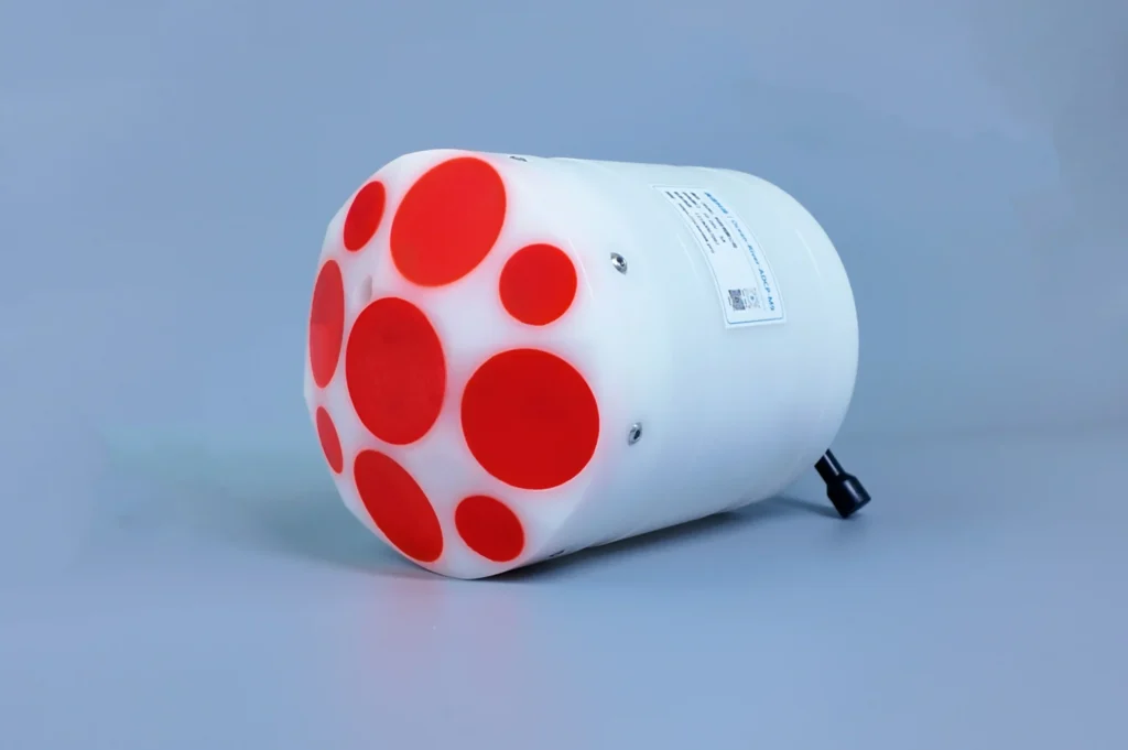
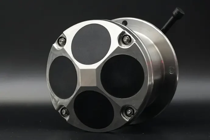
Oceantek DVLs use a 4-beam convex Janus array with a 30° beam angle from vertical. This configuration simultaneously resolves three-dimensional velocity vectors — forward, lateral, and vertical — plus altitude above the seabed.
2.2 DVL + INS: The Gold Standard for Underwater Navigation
The DVL provides true bottom-referenced velocity. The INS provides attitude and angular rate. Fused through a Kalman filter, they form the backbone of modern subsea navigation:
- DVL constrains INS drift: External velocity observations continuously correct the inertial integration error
- INS bridges DVL dropouts: During brief acoustic outages, inertial propagation maintains navigation continuity
- Combined accuracy: A well-tuned SINS/DVL integrated system typically achieves 0.1%–0.5% of distance traveled in positioning accuracy
2.3 Why 300 kHz and 600 kHz Are the Industry Workhorses
| Frequency | Bottom-Tracking Range | Accuracy | Typical Operating Depth |
|---|---|---|---|
| 300 kHz | 0.7–220 m | ±0.5% ±5 mm/s | Continental shelf, mid-water |
| 600 kHz | 0.7–120 m | ±0.3% ±3 mm/s | Coastal, shallow high-precision |
300 kHz is for range. 600 kHz is for resolution. Oceantek’s DVL-300 and DVL-600 each dominate one of these two essential operating envelopes.
3. Oceantek DVL Series: A Deep Technical Dive
Developed in partnership with the Chinese Academy of Sciences Institute of Acoustics — an institution with over five decades of underwater acoustics R&D — Oceantek’s DVL lineup targets the full spectrum of AUV and ROV navigation requirements. Below we dissect the two flagship models: the DVL-600-DR-FA4 and DVL-300-DR-FA4.
3.1 DVL-600-DR-FA4: High-Precision Shallow-Water Workhorse
Core Specifications
| Parameter | Specification |
|---|---|
| Operating Frequency | 600 kHz |
| Bottom-Tracking Range | 0.7–120 m |
| Bottom-Track Accuracy | ±0.3% ±3 mm/s |
| Velocity Resolution | 1 mm/s |
| Altitude Accuracy | ±1% ±0.5 cm |
| Altitude Resolution | 1 mm |
| Data Update Rate | 2 Hz (typical) |
| Max Operating Depth | 6,000 m (titanium housing) |
| Beam Configuration | 4 beams, convex array |
| Beam Angle | 20° (from vertical) |
| Beam Width | 3.5° |
Physical Specifications
| Parameter | DVL-600k(1000m) | DVL-600k(3000m) | DVL-600k(6000m) |
|---|---|---|---|
| Dimensions (H × Dia.) | 148 mm × 150 mm | 148 mm × 157 mm | 148 mm × 167 mm |
| Weight in Air | 3.5 kg | 4.8 kg | 5.7 kg |
| Weight in Water | 2.8 kg | 3.8 kg | 4.6 kg |
Integrated Sensors
| Sensor | Range | Accuracy | Resolution |
|---|---|---|---|
| Temperature | -40°C to 70°C | ±0.1°C | 0.1°C |
| Attitude (Roll/Pitch) | ±85° | ±0.2° | 0.1° |
| Heading (calibrated) | 0–360° | ±0.8° | 0.1° |
Electrical & Communication
- Supply Voltage: 20–50 VDC
- Transmit Power: ≤10 kW
- Communication Interfaces: RS422 / RS232
- Internal Storage: 64 GB
- Protocol Compatibility: PD0 (fully compatible with Teledyne RDI/TRDI)
- Continuous Operation: ≥180 days
- Operating Temperature: -5°C to 45°C (≤93% RH)
- Housing Material: Titanium alloy (standard)
3.2 DVL-300-DR-FA4: Long-Range Mid-to-Deep Water Specialist
Core Specifications
| Parameter | Specification |
|---|---|
| Operating Frequency | 300 kHz |
| Bottom-Tracking Range | 0.7–220 m |
| Bottom-Track Accuracy | ±0.5% ±5 mm/s |
| Velocity Resolution | 1 mm/s |
| Altitude Accuracy | ±1% ±0.5 cm |
| Altitude Resolution | 1 mm |
| Heading Accuracy | ±2° |
| Data Update Rate | 2 Hz |
| Max Operating Depth | 1,000 m / 3,000 m / 6,000 m (selectable) |
| Housing Material | Titanium alloy (standard) |
| Operating Mode | Direct reading |
Key Advantages
- 220 m bottom-tracking range: Covers the vast majority of continental shelf operations — outperforms many competing 300 kHz-class DVLs in range
- 2 Hz update rate: Twice the refresh rate of the 600 kHz model, delivering faster navigation feedback essential for dynamic maneuvering
- Depth rating options: Available in 1,000 m, 3,000 m, and 6,000 m variants — pay only for the depth capability your mission requires
- Titanium alloy as standard: No premium upcharge for corrosion-proof, non-magnetic housing that lasts the life of the vehicle
3.3 DVL-300 vs. DVL-600: How to Choose
| Parameter | DVL-300-DR-FA4 | DVL-600-DR-FA4 |
|---|---|---|
| Frequency | 300 kHz | 600 kHz |
| Bottom-Tracking Range | 0.7–220 m | 0.7–120 m |
| Typical Depth Zone | Mid-water to deep-sea | Shallow to mid-water |
| Data Update Rate | 2 Hz | 2Hz |
| Velocity Resolution | 1 mm/s | 1 mm/s |
| Integrated Sensors | Temp / Attitude / Heading / Altimeter | Temp / Attitude / Heading / Altimeter |
| Water Current Profiling | — | – |
| Best For | Long-range AUV, deep-water ROV | High-precision shallow nav, coastal ROV |
| Max Depth | 6,000 m | 6,000 m |
📌 Selection Guide:
- If your AUV operates primarily in 100–200 m water depth across the continental shelf, the DVL-300‘s extended range is the decisive advantage
- If missions concentrate in shallow water (<120 m) and you need current profiling data plus integrated attitude and heading, the DVL-600 is the superior choice
- For multi-role platforms with varied depth requirements, dual-DVL configurations provide full water-column coverage with hot-swap redundancy
4. What Makes Oceantek DVL Technically Distinctive
4.1 Chinese Academy of Sciences Acoustics R&D Pedigree
Oceantek DVLs are developed with technical backing from the Institute of Acoustics, Chinese Academy of Sciences — one of the world’s leading underwater acoustics research institutions, with a track record spanning over 50 years in transducer design, acoustic propagation modeling, and sonar signal processing. This is not a commodity product assembled from off-the-shelf components; it is a research-grade instrument with institutional depth behind it.
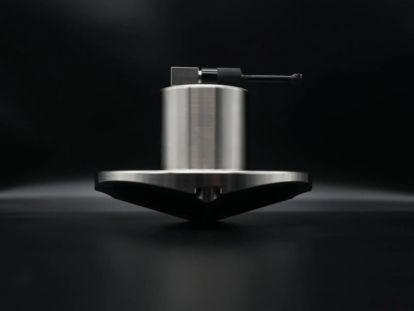
4.2 Titanium Alloy Housing as Standard
In marine engineering, titanium is the undisputed “deep-sea metal.” It offers an unmatched combination of specific strength, seawater corrosion immunity, and non-magnetic properties (zero compass deviation). While many DVL manufacturers charge a substantial premium for titanium — often making it an option reserved for deep-rated variants — Oceantek ships it as standard across the entire DVL lineup. Over a multi-year deployment cycle, this translates to measurable differences in reliability, maintenance intervals, and total cost of ownership.
4.3 PD0 Protocol Compatibility: Drop-In Replacement
Oceantek DVLs output data in the PD0 binary format, fully compatible with Teledyne RDI/TRDI systems. For integration teams with existing Teledyne-based navigation stacks, switching to Oceantek requires minimal to zero changes to the upper-layer navigation filter, data logging pipeline, or post-processing workflow. This is a significant advantage for programs seeking supply-chain diversification without the cost of re-integration.
4.4 Ping-by-Ping Bottom Tracking
Unlike batch-processing DVLs that introduce latency by averaging multiple pings before output, Oceantek DVLs deliver independent velocity data on every acoustic ping. This low-latency architecture is critical for real-time obstacle avoidance, precision station-keeping, and hovering maneuvers where even a few hundred milliseconds of delay degrades control authority.
4.5 Compact Form Factor
The DVL2-600k variant measures just 248 mm in height × 225 mm in diameter and weighs 19 kg in air — a competitive size-to-performance ratio in the 600 kHz DVL class. For space-constrained compact AUVs, every millimeter and kilogram saved on the navigation payload translates directly into mission sensor or battery capacity.
5. Where DVL Navigation Is Heading: Insights from 2024–2025 Research
The hardware accuracy of research-grade DVLs has plateaued near the ±0.3% level. The frontier is shifting toward algorithmic intelligence — how velocity data is processed, fused, and compensated. Key developments from the 2024–2025 literature:
5.1 AI/ML-Enhanced DVL Velocity Estimation
The UDON (Underwater DVL Optimization Network), published in Drones (January 2025), demonstrated an end-to-end deep learning approach that uses raw IMU data (gyroscopes + accelerometers) to refine DVL velocity estimates toward GPS-quality vectors. Results showed:
- Up to 69.26% improvement in velocity RMSE
- Up to 78.62% improvement in relative trajectory error
5.2 Intelligent Bridging During DVL Outages
The ST-BeamsNet Extended model (OCEANS 2025) tackles prolonged DVL signal loss — up to 50 seconds of complete acoustic dropout. Compared to pure inertial dead-reckoning:
- Velocity RMSE improved by 63%
- Final position error reduced by 95%
This capability fundamentally expands the safety envelope for autonomous AUV operations: a brief DVL outage no longer means a lost vehicle.
5.3 Gaussian Process Regression for Adaptive Fusion
Presented at IEEE/ION PLANS 2025, the Multi-Output Gaussian Process Regression (MOGPR) approach goes beyond velocity estimation to output measurement covariance alongside each velocity vector. This allows the Kalman filter to adaptively weight DVL measurements based on real-time uncertainty. On real AUV datasets, MOGPR achieved a further ~20% velocity error reduction over both traditional Least Squares estimation and the deep learning model BeamsNet.
💡 Strategic Insight: Oceantek DVL hardware accuracy already competes at the international tier-one level. The next layer of competitive differentiation will come from deep integration with AI-driven filtering, adaptive covariance estimation, and outage-resilient navigation — turning precision hardware into an intelligent navigation subsystem.
6. Real-World Application Scenarios
6.1 AUV Pipeline & Cable Survey
Subsea pipeline and telecom cable inspection demands that AUVs track linear infrastructure with meter-level accuracy over distances of tens of kilometers. The DVL-300’s 220 m bottom-tracking range maintains seabed lock across continental shelf depths, while the precise velocity data fed into the INS/DVL fusion filter ensures uninterrupted pipeline following — even during course reversals and cross-track maneuvers.
6.2 ROV Construction & Intervention
Subsea construction — wellhead installation, manifold placement, jumper connection — requires sub-meter dynamic positioning. The DVL-600’s ±0.3% accuracy, combined with a narrow 2° beam width for high spatial resolution, provides the real-time velocity feedback that ROV Dynamic Positioning (DP) systems depend on for precision station-keeping in currents.
6.3 Deep-Sea Scientific Exploration
Sampling hydrothermal vents, cold seeps, and abyssal ecosystems at 6,000 meters demands navigation hardware that tolerates extreme pressure, corrosive fluids, and temperature extremes while operating continuously for months. Oceantek’s titanium-housed, 6,000 m-rated DVL with its 180-day continuous endurance is purpose-built for these mission profiles.
6.4 Multi-AUV Cooperative Survey
A 2025 study in Measurement Science and Technology demonstrated that when a multi-AUV formation designates one master vehicle equipped with a DVL, slave vehicles can achieve cooperative localization through acoustic ranging alone (Teng et al., 2025). Oceantek DVL’s high reliability as the master navigation node underpins the stability of the entire cooperative architecture.
7. Frequently Asked Questions
How does Oceantek DVL accuracy compare with Teledyne and Nortek?
Both the DVL-300 and DVL-600 are rated at ±0.3% ±3 mm/s bottom-track accuracy — the same specification tier as the Teledyne Pathfinder series and Nortek DVL family. In integrated SINS/DVL navigation, with proper Kalman filter tuning, the combined system typically achieves 0.1%–0.5% of distance traveled in positioning accuracy.Is titanium housing really necessary, or is it marketing?
For short-duration shallow-water operations (<500 m), aluminum or POM housings are functionally adequate. However, real marine environments are far more aggressive than laboratory corrosion tests suggest — salt spray, biofouling, galvanic corrosion, and crevice corrosion degrade non-titanium housings over multi-year deployment cycles. For deep-water, long-endurance missions, titanium is not a luxury — it is an operational reliability requirement. Oceantek’s decision to make it standard eliminates a common cost-versus-risk trade-off.Can the DVL maintain bottom lock in turbid water?
It depends on turbidity level. Under moderate suspended sediment loads, the 600 kHz DVL maintains reliable bottom tracking within its 120 m range despite slightly higher acoustic attenuation at higher frequencies. In extreme conditions — such as near-bottom nepheloid layers or dredging plumes — switching to the 300 kHz model provides better penetration through the lower-frequency acoustic channel. The 4-beam Janus configuration also provides redundancy: even if one or two beams are partially obstructed, velocity estimation continues through the remaining beams.Can I run both DVL-300 and DVL-600 on the same AUV?
Absolutely — and this is standard practice for premium AUVs. In mid-depth zones (>120 m altitude), the DVL-300 maintains bottom lock with its extended range. When the vehicle ascends into shallow water (<120 m), the navigation computer can automatically switch to the DVL-600 for higher-resolution data and current profiling. Many navigation processors also support dual-DVL hot-standby redundancy — if one unit experiences an outage, the other takes over seamlessly.What communication protocols does Oceantek DVL support?
Three interfaces: RS422, RS232, and 10M Ethernet. All output data conforms to the PD0 standard binary protocol — the de facto industry format established by Teledyne RDI. For programs already invested in the Teledyne software ecosystem, PD0 compatibility means Oceantek hardware integrates with minimal software modification to your existing navigation filters, data loggers, and post-processing chain.What does the “DR-FA4” model suffix mean?
DR = Direct Reading — all velocity and sensor data streams in real time with no onboard averaging latency. FA4 = Functional Advanced, 4th Generation — this designation indicates the inclusion of integrated attitude and heading sensors, calibrated heading output, and (on the DVL-600) water current profiling capability.
8. Conclusion: Can Oceantek DVL Solve Underwater Positioning?
The answer is yes — with clearly defined boundary conditions.
What It Solves:
- ✅ The GPS-denied underwater environment — DVL provides absolute bottom-referenced velocity where satellite signals cannot reach
- ✅ INS drift accumulation — SINS/DVL fusion improves positioning accuracy by 1–2 orders of magnitude over pure inertial navigation
- ✅ Precision seabed-relative velocity measurement at ±0.3% ±3 mm/s
- ✅ Full ocean-depth coverage from shallows to 6,000 meters
- ✅ Drop-in compatibility with existing Teledyne PD0-based navigation ecosystems
Honest Boundaries:
- ⚠️ DVL requires seabed acoustic returns — in mid-water columns beyond bottom-tracking range, the DVL cannot function independently and must be augmented by other velocity references (ADCP water tracking, USBL, or pressure-derived depth rate)
- ⚠️ End-to-end positioning accuracy depends equally on INS/DVL filter quality — the DVL is half the equation; the fusion algorithm is the other half
- ⚠️ In extreme turbidity or heavy aeration (propeller wash, plunging breakers), bottom-track dropouts can occur — though the 4-beam redundancy and outage-bridging algorithms mitigate this
Bottom Line
The Oceantek DVL-300-DR-FA4 and DVL-600-DR-FA4 compete at the international tier-one level across the three dimensions that matter most: hardware accuracy, build quality, and operational reliability. Standard titanium housings, 6,000-meter depth certification, PD0 protocol compatibility, and the technical backing of the Chinese Academy of Sciences Institute of Acoustics collectively form a credible and defensible product value proposition.
For AUV and ROV integrators and operators seeking a DVL solution that delivers competitive performance, faster lead times, and responsive technical support — the Oceantek DVL series deserves a place on your technical evaluation shortlist.
📩 Request Technical Datasheets & Quotation
Visit oceanadcp.com/products/dvl/ or contact the Oceantek technical sales team for product specifications, integration support, and pricing.
References
- Huang et al., “GNSS-aided installation error compensation for DVL/INS integrated navigation system using error-state Kalman filter,” Measurement, 2025. DOI
- “Underwater DVL Optimization Network (UDON): A Learning-Based DVL Velocity Optimizing Method for Underwater Navigation,” Drones, January 2025.
- Cohen & Klein, “Gaussian Process Regression for Improved Underwater Navigation,” IEEE/ION PLANS 2025.
- ST-BeamsNet Extended — Transformer-based navigation during prolonged DVL outages, OCEANS 2025.
- Teng et al., “Multi-AUV cooperative localization system without bottom tracking velocity assistance,” Measurement Science and Technology, 2025.
- Oceantek DVL-300-DR-FA4 / DVL-600-DR-FA4 Product Specifications, oceanadcp.com.
- “Acoustic & Integrated Navigation Systems Enable Tetherless Operation of Hovering AUVs,” Unmanned Systems Technology.