Introduction
The Amazon River is simultaneously the most important river on Earth to measure—and one of the most difficult.
With an average discharge of approximately 209,000 cubic meters per second and peak floods exceeding 340,000 m³/s, the Amazon shapes the climate, ecology, and economies of eight nations. In October 2024, the Rio Negro dropped to just 12.66 meters—well below its usual 21 meters—halting navigation and underscoring the urgent need for reliable flow data.
The measurement challenges are immense: the river can rise 10 meters during annual floods, carries massive floating debris, and flows over a mobile sandy bed that biases traditional instruments. According to USGS guidance, “stationary bed tests simply are not adequate” for such large rivers.
This article explains how direct-reading ADCP technology—specifically in the 600 kHz class—addresses each of these Amazon‑specific challenges, from execution in under 15 minutes to real‑time moving‑bed correction.
Key Takeaways:
- Debris & mobility: ADCP profilers avoid entanglement and measure while moving; traditional meters cannot.
- Speed advantage: One ADCP completes a full transect in minutes vs. hours for mechanical methods—critical when flow changes rapidly.
- Real‑time control: A cable‑connected deck unit lets operators spot and correct moving‑bed bias immediately.
- Field‑proven: At Manacapuru, Brazil, ADCP completed 34 measurements in 4 days; traditional methods would have managed only 3.
1. Why Amazon River Flow Measurement Matters
Accurate flow measurement in the Amazon is critical for two interconnected reasons: transboundary water resource management and ecological conservation.
The Amazon Basin spans roughly 7 million km² across eight countries. Implementing Integrated Water Resources Management (IWRM) across this vast basin demands reliable discharge data. Without it, water allocation, drought planning, and infrastructure investments are built on guesswork.
The ecological stakes are equally high. The Western Amazon alone harbors 74% of the basin’s fish species and supplies nearly all the sediments that reach the Atlantic. These sediments sustain floodplain agriculture, wetlands, and fisheries that support millions of people. Furthermore, monitoring flow is essential for managing the more than 150 hydropower dams already operating in Amazon tributaries.
For navigation and trade, flow measurement is an economic lifeline. The 2024 drought halted barge traffic and cut off riverside communities, showing how deeply the region’s economy depends on hydrological conditions.
2. Challenges of Measuring Flow in Debris‑Heavy, Deep‑Water Environments
Traditional point‑velocity methods face three fundamental challenges in the Amazon, each capable of making measurements unreliable or impossible.
2.1 Massive Floating Debris Load
The Amazon carries enormous quantities of floating woody debris—trees, branches, and vegetative mats—especially during the rising-water period.

- Fouling: Debris fouls mechanical current‑meter rotors and tangles suspension cables.
- Damage risk: Large debris can sweep away instruments deployed on fixed verticals.
Research confirms that “accumulations of floating woody debris cause systematic errors” in depth and velocity measurements, particularly during high flow.
2.2 Extreme Depth and Width
Main‑stem measuring stations often exceed 50–60 m depth during flood, with channel widths measured in kilometers.
- Time drain: A mechanical meter lowered to just two depths per vertical takes over an hour for one cross‑section.
- Unsteady flow: During that hour, discharge in a tidally‑influenced reach or on a rising hydrograph can change by more than 20%, making the measurement unrepresentative.
2.3 The Moving‑Bed Problem
Perhaps the most insidious challenge: the Amazon transports large volumes of sand near the streambed at high velocities.
- False displacement: This near‑bed sediment movement tricks an ADCP’s bottom‑tracking into perceiving a false upstream drift of the instrument.
- Systematic bias: Research at Óbidos confirmed “a systematic error linked to the displacement of the river bottom” when using uncorrected ADCP data.
- USGS warning: Discharge will be biased low if a moving bed is present, and simple stationary tests are insufficient.
3. Direct‑Reading ADCP Solution: Real‑Time Profiling in the Amazon
Direct‑reading ADCPs overcome each of these challenges through profiling speed, debris resilience, and real‑time data feedback.
3.1 Why Direct‑Reading?
A direct‑reading (shipboard) ADCP connects the submerged transducer to an on‑board deck unit via cable, displaying velocity, depth, and discharge in real time as the boat crosses the river.
- Immediate QC: Operators can spot problems (moving‑bed bias, acoustic interference) instantly and repeat measurements before demobilizing.
- Full control: Unlike self‑contained ADCPs that only reveal data after download, a direct‑reading system lets you make decisions on the spot—crucial in remote Amazon campaigns.
3.2 Debris Avoidance and Operational Resilience
A vessel‑mounted ADCP profiles downward from a rigid mount well below floating debris.
- Maneuverability: If debris is encountered, the boat can simply avoid it or repeat the transect—flexibility impossible with stationary vertical measurements.
- Frequency fit: The 600 kHz class is ideal for Amazon depths. With a profiling range of 55 m (broadband) and 70 m (narrowband), and a bottom‑track range of 0.8–120 m, it covers most main‑stem sections. For depths exceeding 70 m, a 75 kHz phased‑array ADCP (profiling up to 650 m) can be deployed.
3.3 Real‑Time Moving‑Bed Detection and Correction
The live display enables on‑site moving‑bed tests.
- Loop test: The boat completes a closed path while the ADCP tracks bottom velocity. If the apparent trajectory does not close, a moving bed is present.
- Correction: If the bias exceeds ~1% of mean velocity, the operator switches the velocity reference from bottom‑track to differential GPS, or applies post‑processing loop‑closure correction.
3.4 Key Specifications for Amazon Conditions
| Specification | Value (600 kHz class) | Relevance to Amazon |
|---|---|---|
| Velocity accuracy | ±0.3% ± 3 mm/s | Detects subtle flow changes between drought and flood |
| Velocity range | ±5 m/s default; ±20 m/s max | Covers main‑stem velocities (1–3 m/s, up to >4 m/s in narrows) |
| Profiling range | 55 m / 70 m | Sufficient for most sections; supplemented by 75 kHz for deepest channels |
| Bottom‑track range | 0.8–120 m | From near‑bank shallows to deepest thalweg |
| Data output | Real‑time via cable | Enables immediate QA/QC and moving‑bed tests |
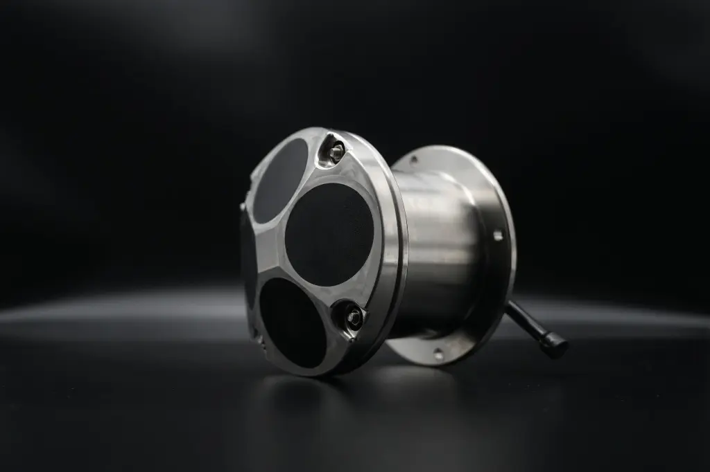
| Housing | Titanium alloy (standard on Oceantek ADCPs) | Eliminates corrosion concerns in tropical waters |
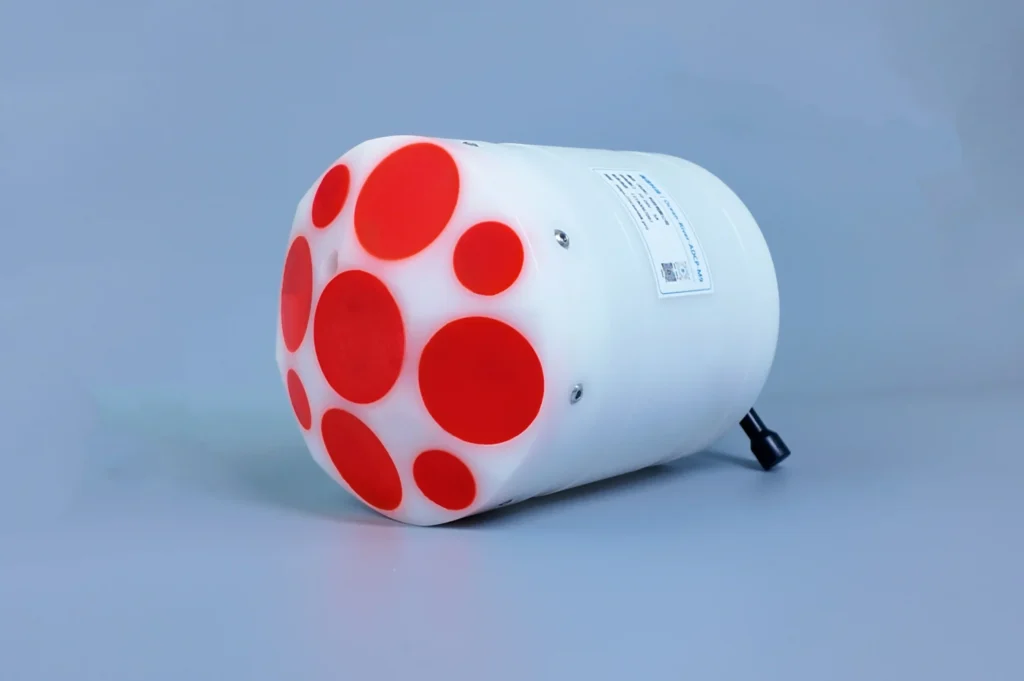
Specifications reference the Oceantek ADCP‑600‑DR‑FA4.
4. Step‑by‑Step Measurement Procedure
Step 1: Site Selection and Pre‑Deployment Checks
- Location: Choose a straight reach, at least 5–10 channel widths from bends or confluences, with uniform geometry.
- Hardware check: Clean the transducer face; apply silicone grease to connector O‑rings.
- Calibration: Calibrate the internal compass per manufacturer’s procedure.
- Configuration: Set the number of bins (30–50 for Amazon depths), bin size (0.5–1.0 m), blanking distance, and bottom‑track mode.
- Mounting: Rigid‑mount the ADCP with beam #3 toward the bow, transducer submerged at least 0.3–0.5 m below the surface to avoid aeration.
Step 2: Conduct the Moving‑Bed Test
- Hold position mid‑channel for 2–3 minutes while recording bottom‑track velocity. If boat speed appears when GPS shows stationary, a moving bed is present.
- Loop test: Navigate a closed loop. If the bottom‑tracked trajectory fails to close by more than ~1% of mean velocity, moving bed is significant.
- Mitigation: Switch to DGPS as the primary velocity reference, or plan loop‑closure correction during post‑processing.
Step 3: Execute Discharge Transects
- Edge start: Begin near one bank, close enough to measure near‑shore velocity but with all beams in the water.
- Steady traverse: Cross the river at 0.5–1.0 m/s, perpendicular to flow.
- Edge distance: End as close to the far bank as safely navigable. The software will estimate unmeasured edge discharge.
- Real‑time monitoring: Watch for profile gaps or sudden bottom‑track loss on the deck‑unit display.
- Reciprocal transects: Immediately perform a second transect in the opposite direction. Average the pair; if discharge differs by >5%, repeat.
Step 4: On‑Site Data Quality Review
Before leaving the station, verify:
- Consistency: Reciprocal transects within 5%.
- Bottom‑track quality: Continuous lock throughout.
- Beam correlation: All four beams above the recommended threshold.
- Moving‑bed correction: Applied if needed, with corrected discharge aligning with expectations.
- Extrapolation: Top and bottom discharge extrapolations reasonable for the channel geometry.
5. Data Output and Analysis
5.1 Real‑Time Display and Raw Data
The deck unit shows a live cross‑section view—depth, velocity contour, boat track, error velocity, and backscatter. Raw files contain:
- 3D velocity components for every bin and ensemble
- Bottom‑track velocity and range per beam
- Time, position, heading, pitch, roll
- Acoustic backscatter intensity
- Instrument configuration and calibration parameters
5.2 Discharge Computation
Total discharge is the sum of:
- Measured discharge: central portion where all beams are in the water.
- Top extrapolation: from shallowest measured bin to surface (power‑law profile).
- Bottom extrapolation: from deepest bin to streambed.
- Edge discharge: unmeasured near‑bank regions, estimated from geometry and nearest measured vertical.
5.3 Typical Amazon Velocity Distribution
- Normal flow: 1.5–3.0 m/s; flood in constrictions up to 3.5–4.5 m/s.
- Óbidos narrows: Velocities can exceed 4.0 m/s.
- Profile shape: Logarithmic/power‑law; surface velocity ~15–20% higher than depth‑averaged.
- Secondary circulation: Visible in meandering reaches as cross‑channel velocity components.
- Near‑bed reduction: Degree of reduction depends on sand mobility.
5.4 Comparison with Historical Data
At stations operated by ANA (Brazil’s National Water Agency) or the HiBAm research program, each ADCP measurement is compared against the established stage‑discharge rating curve. A deviation may indicate:
- A real hydraulic change (scour, deposition).
- Moving‑bed bias if uncorrected.
- Unsteady flow during the measurement.
Because the direct‑reading ADCP gives real‑time results, operators can investigate these discrepancies on site, rather than weeks later in the office.
6. Case Highlight: HiBAm Manacapuru Experiment, Solimões River, Brazil
Project Background
In 2009, researchers from Brazil’s HiBAm program evaluated ADCP technology at the Manacapuru gauging station on the Solimões River (the Amazon above its confluence with the Rio Negro). At the time, discharge was primarily measured with mechanical current meters, producing only 1–3 complete measurements per day.
Method
The team deployed an ADCP from a survey vessel over 4 days, performing reciprocal transects, real‑time quality monitoring, and moving‑bed loop tests. Results were compared directly against the conventional Price‑meter method.
Results
- Throughput: The ADCP completed 34 discharge measurements in 4 days. Traditional methods would have managed a maximum of 3 in the same period.
- Measured discharge: 93,000 m³/s, consistent with Solimões seasonal flow.
- Method comparison: ADCP results differed from the conventional method by ~9%. This difference highlighted a known weakness of the point‑velocity method: when flow changes during the hour‑plus measurement, it captures a temporally aliased snapshot. The ADCP, being nearly instantaneous, “helped solve the problem of scatter associated with the rating curve for Manacapuru.”
Implication for Modern Deployments
The experiment established ADCP as the preferred method for the Amazon Basin. The speed advantage—about 10× the measurement throughput—is not merely about efficiency; it’s about accuracy in a river where discharge can vary by over 100,000 m³/s between seasons.
Frequently Asked Questions
Q1: Why choose ADCP over traditional mechanical current meters for the Amazon?
The Amazon’s extreme depth, width, debris, and mobile bed make mechanical meters impractical. An ADCP completes a full transect in 10–15 minutes, avoids debris by profiling from a moving boat, and detects moving‑bed bias in real time. As the Manacapuru experiment showed, it delivers over 10 times more measurements per day.
Q2: What is the depth range of a direct‑reading 600 kHz ADCP?
Typically 55 m in broadband mode and 70 m in narrowband mode, with bottom‑track from 0.8 to 120 m. This covers the vast majority of Amazon main‑stem sections. For the deepest constrictions (e.g., Óbidos during peak flood), a 75 kHz phased‑array ADCP (up to 650 m) is recommended.
Q3: How is accuracy maintained in high‑sediment Amazon waters?
Through three mechanisms: (1) a moving‑bed loop test to detect bias, corrected by using DGPS as reference; (2) reciprocal transects averaged to check consistency; and (3) real‑time monitoring of beam correlation and error velocity to reject poor‑quality ensembles on the fly.
Q4: Can a direct‑reading ADCP be deployed on an unmanned surface vessel (USV)?
Yes. 600 kHz ADCPs are compatible with USVs, which offer safety advantages in remote reaches. A radio or 4G link replaces the cable, with the USV either following a pre‑programmed transect or being remotely piloted. For extremely wide cross‑sections (3–5 km), however, manned‑boat deployment may be more practical due to battery life.
Learn More About Oceantek Direct-Reading ADCP Solutions
Oceantek manufactures high-precision direct-reading ADCPs purpose-built for the world‘s most demanding hydrological environments — from the Amazon to coastal engineering sites worldwide. Our instruments deliver real-time velocity profiling, compact form factors designed for easy deployment from vessels of any size, and industry-leading reliability with continuous operating endurance exceeding 100 days.
Explore our product line to find the right ADCP for your measurement needs:
View Oceantek Direct-Reading ADCP Product Specifications →
Need expert advice on instrument selection or deployment planning? Contact our technical team sales@oceanadcp.com for application-specific recommendations.