Highlight 1: Nine-Beam Acoustic Architecture — An All-Round Performer for Shallow and Slow Water Current Measurement
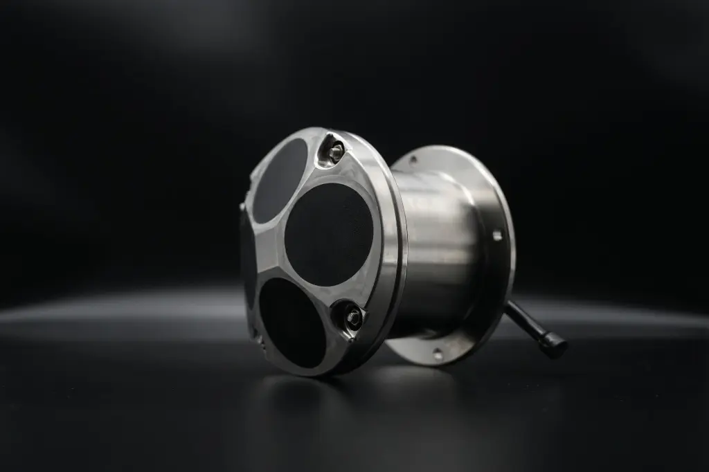
Breaking the limitations of traditional single/dual-beam ADCPs, the River-ADCP-M9 is equipped with a 9-beam acoustic system. It adopts a combined design of dual sets of 4-beam 3.0MHz/1.0MHz Janus configuration + one 0.5MHz vertical echo sounding beam, paired with a 25° beam angle, achieving full coverage measurement in shallow and slow-flow waters:
- Full-profile Fine Measurement: Profile range from 0.06m to 40m; layer thickness adjustable from 0.02m to 4m; customizable layer numbers from 1 to 255. It realizes layered flow pattern capture even in extremely shallow water areas.
- Industry-Grade Current Measurement Accuracy: Typical measurement accuracy ±0.25%±2mm/s, with a velocity resolution up to 1mm/s. It can precisely identify subtle changes in complex flow patterns such as slow flow, pulsating flow and eddies.
- Stable Performance Under Extreme Conditions: Velocity measurement range ±20.0m/s, full-direction flow direction measurement (0–360°) with ±2° accuracy. It maintains stable and reliable data output even under high flow velocity and strong turbulence during flood seasons.
Highlight 2: Multi-Dimensional Sensing Capability — Beyond Current Measurement, Empowering Full-Scenario Monitoring
Beyond core flow velocity measurement, the River-ADCP-M9 functions as a full-factor hydrological monitoring terminal integrating sounding, water level and attitude sensing. A single operation can acquire multi-dimensional data:
- High-Precision Sounding & Topographic Survey: Height measurement resolution up to 0.001m; accuracy up to 0.02% after full-water-column sound velocity correction; measurement range 0.2–80m. The oblique acoustic beam supports topographic mapping up to 40m, providing data support for river erosion and silting analysis.
- Multi-Sensor Collaborative Calibration: Integrated temperature, pressure and attitude compass sensors. Temperature accuracy ±0.1℃, pressure accuracy ±0.25%, heading accuracy 0.8°. Attitude compensation ensures data accuracy even under hull shaking and water flow impact.
- One-Step Discharge Calculation: Supports GNSS/GPS positioning. It rapidly completes river discharge calculation within the water depth range of 0.3–80m, eliminating the cumbersome procedures of traditional manual hydrological surveys.
Highlight 3: Lightweight Engineering-Grade Design — A Worry-Free Tool for Field Operations
Targeting the pain points of complex operating environments and difficult deployment in river monitoring, the River-ADCP-M9 is optimized in structure and durability, achieving portability, durability and stability in one:
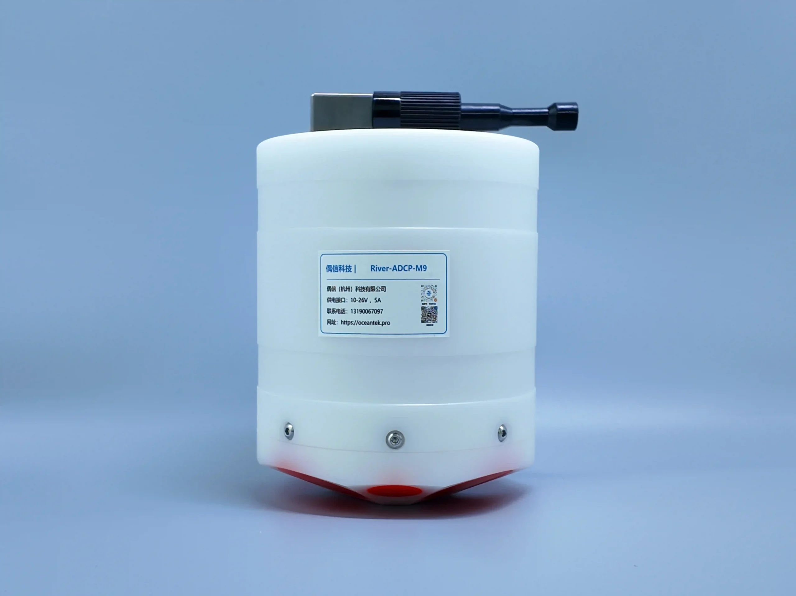
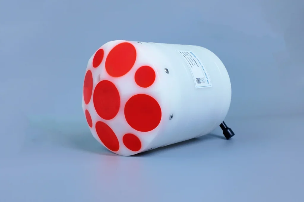
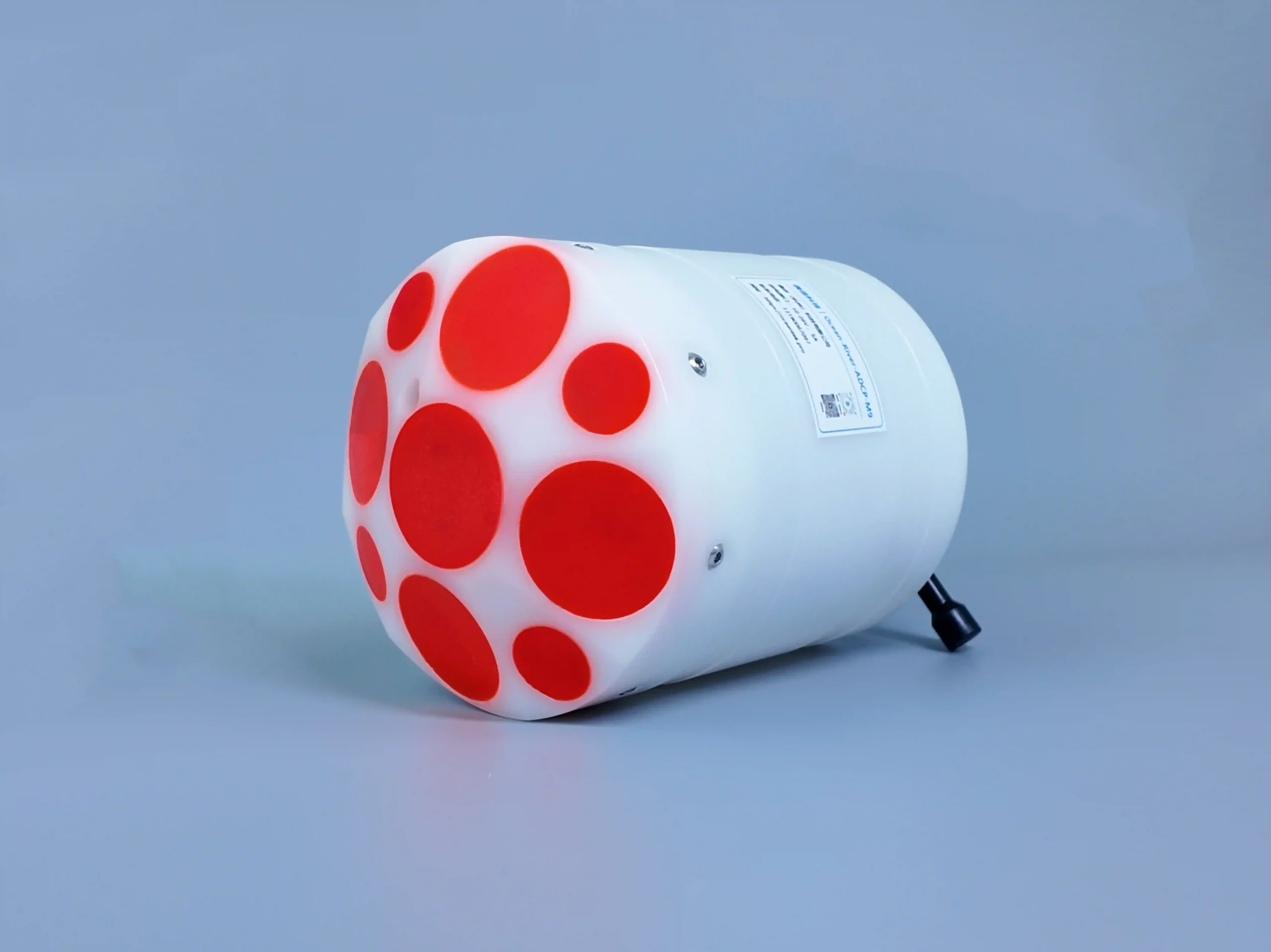
- Ultra-Lightweight for Single-Person Deployment: Weight ≤1.5kg in air, dimension only Φ128mm×168mm. Quick deployment by a single operator greatly improves field operation efficiency.
- Wear-Resistant POM Housing Against Sediment Erosion: Corrosion-resistant and impact-resistant POM material withstands long-term scouring by sediment and floating debris in rivers, ideal for long-term monitoring in high-sediment watercourses.
- Wide Temperature & Voltage Adaptation for Extreme Environments: Operating temperature: -5℃ to 45℃; storage temperature: -40℃ to 70℃; 10–26V power supply interface; pressure resistance up to 50m. It operates steadily under extreme conditions such as rainstorms, floods and low temperatures.
Highlight 4: Efficient Data Processing — Accelerating Hydrological Early Warning
Data transmission and storage capacity directly determine the efficiency of emergency monitoring and routine operation & maintenance. The River-ADCP-M9 delivers outstanding data performance:
- Large-Capacity Storage Reduces Frequent Data Export: Built-in 64GB memory supports massive data storage, meeting the demands of long-term unattended field operations.
- High Refresh Rate for Real-Time Zero-Delay Data: Maximum data refresh rate (output rate) 2Hz, internal sampling rate up to 70Hz. Equipped with RS-232/RS-422 communication interface, it supports real-time data transmission and provides second-level response support for flood early warning and emergency disposal.
Highlight 5: Multi-Scenario Empowerment — Unlocking More Possibilities for River Monitoring
Powerful core performance enables the River-ADCP-M9 to adapt easily to a wide range of river monitoring scenarios:

- Flood Control, Drought Relief & Hydrological Forecasting: Real-time monitoring of cross-section flow velocity and discharge to provide accurate data for flood prediction and water resource regulation.
- River Regulation & Ecological Protection: Fine flow field and topographic measurement support river erosion-silting analysis and ecological flow assessment.
- Water Conservancy Project Operation & Maintenance: Construction-period monitoring and operational safety guarantee for hydropower stations, bridges, waterways and other projects.
- Emergency Monitoring & Disposal: Lightweight and rapidly deployable, it can be quickly put into service during emergencies such as floods and dam breaches。