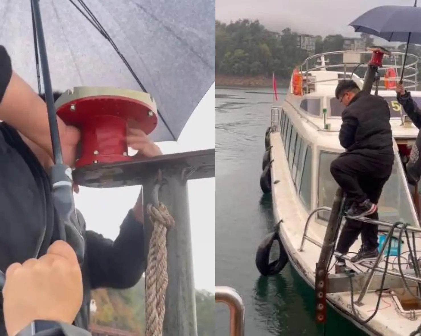
You are planning a survey. You have a budget. You need equipment that works — the first time. This guide is written for project managers, procurement teams, and field engineers who need to make an informed equipment decision without wading through marketing brochures. It covers what each instrument actually does, what it costs, and how to match it to your project.
Every recommendation below is based on real field deployments. No theory-only advice.
Table of Contents
- 1. Quick Reference: Which Equipment for Which Project?
- 2. ADCP — When You Need to Measure Currents
- 3. DVL — When You Need Underwater Navigation
- 4. Sonar & Bathymetry Equipment
- 5. Hydrophones & Passive Acoustic Monitoring
- 6. CTD, Current Meters & Supporting Instruments
- 7. Budget Realities: What Marine Survey Equipment Actually Costs
- 8. The 5-Step Selection Framework
- 9. Frequently Asked Questions
1. Quick Reference: Which Equipment for Which Project?
If you only have 60 seconds, start here. Match your project type to the core equipment you need:
| Project Type | Core Equipment | Supporting Gear | Budget Range (Equipment Only) |
|---|---|---|---|
| Hydrographic Survey Seabed mapping, charting, wreck surveys | Multibeam echosounder + ADCP | CTD (sound speed), GNSS, MRU | $35K–$120K+ |
| Offshore Wind Resource Assessment Met-ocean measurements, foundation design input | Self-contained ADCP (300 kHz or 75 kHz) | Mooring frame, buoyancy, CTD | $18K–$45K |
| River Discharge Monitoring Flood warning, water resource management | River-type ADCP (600 kHz M9) or H-ADCP | Mounting frame, cable, power supply | $12K–$28K |
| AUV / ROV Navigation Subsea positioning, autonomous survey | DVL + INS | USBL positioning, pressure sensor | $20K–$55K |
| Marine Mammal Monitoring (PAM) Offshore construction compliance, research | Self-contained hydrophone(s) | Mooring, acoustic release, CTD | $5K–$25K |
| Environmental Baseline Study Pre-construction impact assessment | CTD + ADCP + hydrophone | Water sampler, turbidity sensor | $25K–$65K |
Not sure which category you fall into? Jump to the 5-Step Selection Framework for a systematic approach.
2. ADCP — When You Need to Measure Currents
The Acoustic Doppler Current Profiler (ADCP) is the most frequently purchased instrument in marine survey work. If you need to know how fast water is moving — and at what depths — this is your tool. A single ADCP replaces dozens of single-point current meters by measuring velocity at every depth simultaneously.
How an ADCP Works (30-Second Version)
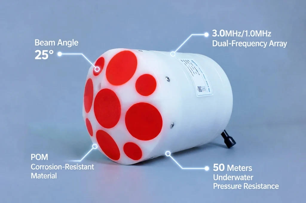
An ADCP sends acoustic pulses into the water through 4 or 5 angled transducer beams. Particles in the water — sediment, plankton, bubbles — reflect these pulses back. The returning echo is Doppler-shifted: the frequency change tells you water velocity. By time-gating the return signal into “bins,” the ADCP resolves velocity at 50 to 200 depth layers at once. Read the full technical explanation →
Choosing Your ADCP: Three Decisions
Decision 1: Configuration
| Configuration | How It’s Deployed | Best For | Limitation |
|---|---|---|---|
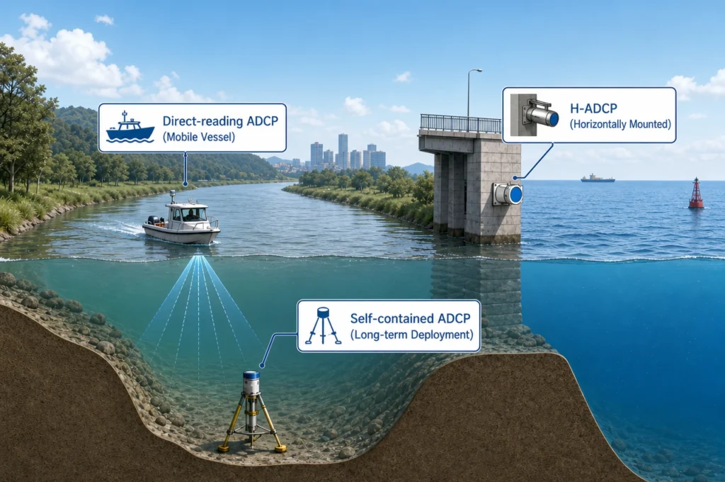
| Direct-Reading | Vessel-mounted, cabled to surface laptop | Real-time survey transects, instant QC, DP reference | Requires vessel + operator presence |
| Self-Contained | Bottom-mounted on frame, autonomous recording | Months-long deployments, offshore wind, deep ocean | No real-time data; recover to download |
| Horizontal (H-ADCP) | Side-looking, fixed to riverbank or bridge pier | Continuous river monitoring, flood early-warning | Single horizontal layer; needs index-velocity calibration |
Decision 2: Frequency
This is the single most important spec. Lower frequency = longer range but coarser resolution. Higher frequency = finer detail but shorter range.
| Frequency | Max Depth | Resolution (Bin Size) | Typical Application |
|---|---|---|---|
| 600 kHz | 50–70 m | 0.5–4 m | Rivers, estuaries, harbors, shallow coastal surveys |
| 300 kHz | 120–160 m | 1–8 m | Coastal oceanography, offshore wind, continental shelf |
| 75 kHz | 550–650 m | 8–32 m | Deep-ocean moorings, basin-scale circulation |
Decision 3: Number of Beams
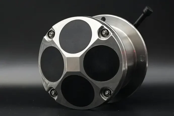
Standard ADCPs use 4 beams (the minimum for 3D velocity). A 5th vertical beam — like on the River ADCP M9 — provides a direct measurement of vertical velocity and improves data quality in high-turbulence conditions. For most coastal and offshore surveys, 4 beams are sufficient. For precision river discharge work, 5 beams are worth the investment. Read: ADCP Beam Configurations Compared →
Browse Oceantek ADCP products →
3. DVL — When You Need Underwater Navigation
A Doppler Velocity Log (DVL) solves a fundamentally different problem from an ADCP: it tells an underwater vehicle exactly how fast and in what direction it is moving relative to the seabed. Without a DVL, an AUV’s inertial navigation system drifts — typically accumulating errors of several meters per minute. With a DVL, that drift is corrected to centimeters.
ADCP vs DVL: They Are Not Interchangeable
| Characteristic | ADCP | DVL |
|---|---|---|
| Primary Output | Water velocity profile (speed + direction at multiple depths) | Vehicle velocity vector (3-axis speed over ground) |
| Key Metric | Water-profiling range | Bottom-track holding altitude |
| Who Uses It | Hydrographer, oceanographer, hydrologist | AUV/ROV navigator, subsea engineer |
| Integration | Standalone or with GNSS | Fused with INS via Kalman filter |
What to Check Before Buying a DVL
- Maximum altitude: This is the DVL’s most important spec. How far above the seabed can it maintain bottom-lock? For a survey AUV operating at 200 m depth, you need a DVL rated for at least 200 m altitude — which typically means 300 kHz or lower.
- Velocity accuracy: ±0.2% to ±1% of measured speed. For precision survey AUVs, aim for under ±0.5%.
- SWaP (Size, Weight, and Power): Phased-array DVLs like the DVL-600-PA5 offer 50–70% smaller transducer face than piston designs — critical for small-diameter AUVs and gliders.
- Protocol compatibility: Confirm your INS accepts the DVL’s output format (NMEA, PD6 binary, or Ethernet) before purchasing.
Explore Oceantek DVL solutions →
4. Sonar & Bathymetry Equipment
ADCPs measure water velocity. Sonar systems measure seabed geometry and imagery. A complete hydrographic survey deploys both. Here is what each sonar type does:
| Instrument | What It Measures | Output | Typical Use |
|---|---|---|---|
| Multibeam Echosounder (MBES) | Water depth across a wide swath | High-resolution 3D bathymetry | Charting, wreck surveys, habitat mapping |
| Side-Scan Sonar | Acoustic reflectivity of seabed surface | High-res seabed imagery (like b&w photography) | Object detection (wrecks, pipelines, UXO) |
| Sub-Bottom Profiler (SBP) | Sediment layers below the seabed | Cross-section of subsurface geology | Pipeline route assessment, geotech surveys |
| Single-Beam Echosounder | Depth at a single point directly below vessel | Depth profile along track line | Dredging, navigation channels, quick depth checks |
Key integration note: Multibeam data must be corrected for sound speed variations in the water column. This is why a CTD or sound velocity profiler is deployed alongside any multibeam survey — without it, your bathymetry data will have systematic depth errors.
5. Hydrophones & Passive Acoustic Monitoring
A hydrophone is an underwater microphone. It converts acoustic pressure in water into an electrical signal, enabling you to record everything from whale calls to vessel propeller noise to the sound of pile-driving during offshore construction.
Passive Acoustic Monitoring (PAM) using hydrophones is now a regulatory requirement for most offshore construction projects in Europe, North America, and Australia. If you are driving piles, conducting seismic surveys, or operating in marine mammal habitats, you will need hydrophones.
Self-Contained vs. Real-Time
| Type | How It Works | Best For |
|---|---|---|
| Self-Contained Hydrophone | Autonomous deployment with internal battery and storage. Deploy for weeks to months, recover, download data. | Long-term ambient noise baselines, marine mammal presence/absence surveys, deep-ocean acoustics research |
| Real-Time (Cabled) Hydrophone | Connected to surface vessel or shore via cable. Data streams live. | Live PAM during piling (for shutdown criteria), seismic mitigation, real-time detection and localization |
Key Specs to Check
- Bandwidth: Match to your target. Whale calls: 10 Hz–10 kHz. Dolphin clicks: 50–150 kHz. Ambient noise: 1 Hz–100 kHz.
- Sensitivity: Typically -160 to -210 dB re 1V/μPa. Higher is better for quiet environments.
- Self-noise: Must be lower than the ambient noise you are measuring. This is the spec that separates research-grade from industrial hydrophones.
- Depth rating: 200 m for coastal work; 3000–6000 m for deep ocean.
Explore Oceantek hydrophones →
6. CTD, Current Meters & Supporting Instruments
CTD — The Sensor Every Survey Needs
A CTD measures Conductivity (→ salinity), Temperature, and Depth. It is the most fundamental oceanographic sensor. Even if your primary instrument is an ADCP or multibeam, you almost always need a CTD for:
- Sound speed correction for multibeam echosounder data
- Density profiles for understanding water mass structure
- Environmental context for every other measurement
Many modern ADCPs have an integrated CTD. If yours doesn’t, budget for a standalone unit — without one, your bathymetry and acoustic data will have uncorrected errors.
Single-Point Current Meter
If you only need velocity at one depth — and your budget is tight — a single-point current meter costs significantly less than an ADCP. These are deployed in arrays when you need to approximate a velocity profile without the cost of a full ADCP. Browse current meters →
Positioning & Motion Sensors
- GNSS: Surface positioning. Accuracy from sub-meter (standard) to centimeter-level (RTK/PPK).
- USBL: Underwater acoustic positioning. Tracks AUVs, ROVs, and towed instruments from the surface vessel.
- MRU (Motion Reference Unit): Compensates for vessel roll, pitch, and heave. Essential for multibeam surveys — without one, your depth data will be contaminated by wave-induced vessel motion.
7. Budget Realities: What Marine Survey Equipment Actually Costs
Most manufacturers do not publish prices. Here is what you should expect, based on real procurement data across the industry:
| Instrument | Entry-Level | Mid-Range | High-End / Deep-Ocean |
|---|---|---|---|
| ADCP (Direct-Reading) | $12K–18K (600 kHz) | $20K–30K (300 kHz) | $35K–50K+ (75 kHz, deep-ocean) |
| ADCP (Self-Contained) | $15K–22K | $25K–35K | $40K–55K+ |
| DVL | $15K–25K | $25K–40K | $45K–60K+ |
| Multibeam Echosounder | $30K–60K | $80K–150K | $200K–500K+ |
| Side-Scan Sonar | $8K–15K | $20K–40K | $50K–80K+ |
| Hydrophone (Self-Contained) | $3K–6K | $8K–15K | $20K–35K+ (wideband, deep-rated) |
| CTD | $2K–5K | $8K–15K | $20K–40K+ (with rosette) |
Three things to remember about marine survey equipment pricing:
- Accessories add 20–40%. Cables, mounting frames, connectors, deck units, and software licenses are rarely included in the instrument price. Budget accordingly.
- Manufacturer-direct pricing eliminates reseller markup — typically 15–30% savings. Oceantek sells directly; most Western brands go through distributors.
- The cheapest option is rarely the cheapest. An instrument that requires frequent recalibration, has poor manufacturer support, or fails in the field will cost far more in downtime than the difference in purchase price.
Request a customized quotation →
8. The 5-Step Selection Framework
This is the process our application engineers use when helping a new customer specify equipment. It works regardless of which manufacturer you ultimately choose.
Step 1: Name Your Primary Measurement
Be specific. “I need to measure currents” is not specific enough. “I need to measure current velocity at 50 depth layers from 2 m to 150 m depth, in real time, from a survey vessel” — that tells you: direct-reading 300 kHz ADCP.
- Current velocity profile? → ADCP
- Vehicle speed over ground? → DVL
- Seabed shape? → Multibeam / Single-beam echosounder
- Underwater sound? → Hydrophone
- Water properties? → CTD
- Flow at one depth? → Single-point current meter
Step 2: Define Your Depth Range
Depth determines frequency. Frequency determines range and resolution. Use the ADCP frequency table in Section 2. The rule: measure at the deepest point you expect to encounter, plus 20% margin.
Step 3: Choose Deployment Mode
- Vessel-mounted (real-time): You have a boat and need data now. Direct-reading ADCP.
- Autonomous (self-contained): Deploy and leave for weeks/months. Self-contained ADCP or hydrophone.
- Fixed-platform: Permanent installation with shore power. H-ADCP or cabled system.
- Vehicle-integrated: AUV/ROV. DVL with INS fusion.
Step 4: Verify Integration Requirements
Survey instruments never work alone. Before ordering, confirm:
- Positioning: GNSS (surface) or USBL (subsea) — does your instrument accept the positioning data format?
- Motion compensation: MRU/AHRS — required for vessel-mounted ADCP and multibeam
- Acquisition software: Hypack, QINSy, WinRiver II, or custom solution — check driver availability
- Post-processing: QRev (ADCP discharge), MATLAB, Python — ensure data export formats are compatible
Step 5: Calculate Total Cost of Ownership (Not Just Purchase Price)
For a 5-year deployment program, the purchase price is typically 40–60% of total cost. Also budget for:
- Calibration: $1K–3K per instrument every 1–2 years
- Deployment hardware: $2K–10K (frames, buoys, cables, releases)
- Spares: O-rings ($20–100 each), connectors ($50–300), sacrificial anodes
- Software: Some acquisition software licenses cost $5K–15K/year
- Training: Budget 2–5 days of manufacturer-led training for complex systems
9. Frequently Asked Questions
Marine equipment covers everything used in marine environments — ships, engines, deck machinery, navigation systems, safety gear. Marine survey equipment is a specific subset: scientific instruments designed for measuring, mapping, and monitoring the ocean. ADCPs, multibeam echosounders, CTDs, hydrophones, and DVLs all fall under marine survey equipment. When procurement teams search for “marine equipment” for survey work, they mean scientific instruments — not ship hardware.
A standard hydrographic survey package consists of: (1) a multibeam or single-beam echosounder for bathymetry, (2) an ADCP for current measurement (used both for environmental data and to correct vessel motion), (3) a CTD or sound velocity profiler for sound speed correction (essential — without this, multibeam data has systematic depth errors), and (4) a GNSS positioning system with an MRU for motion compensation. Additional instruments — side-scan sonar, sub-bottom profiler, hydrophone — are added based on survey objectives.
Costs scale with capability. A basic river monitoring setup (600 kHz ADCP) starts around $12K–18K. A mid-range coastal survey package (300 kHz ADCP + CTD + GNSS) runs $30K–60K. A full deep-ocean survey suite (75 kHz ADCP + multibeam + sub-bottom profiler + DVL) can reach $200K–500K+. See the detailed price table in Section 7. Most manufacturers do not publish prices — you will need to request quotations for your specific configuration.
No. Each instrument is optimized for a specific measurement. An ADCP measures velocity, not bathymetry. A CTD measures water properties, not currents. A hydrophone measures sound, not depth. Marine surveys deploy multiple instruments simultaneously on the same vessel, mooring, or vehicle. Modern acquisition systems integrate data from several instruments in real time, but no single sensor replaces a properly planned multi-instrument survey.
Five non-negotiable maintenance practices: (1) Fresh-water rinse after every saltwater deployment — salt crystals destroy O-ring seals. (2) O-ring inspection and replacement before every deployment — a $20 O-ring failure destroys a $30K instrument. (3) Transducer face cleaning — biofouling attenuates acoustic signals. (4) Compass calibration verification every 6 months. (5) Factory recalibration every 1–2 years (budget $1K–3K per instrument). Properly maintained survey equipment lasts 10+ years.
A manufacturer designs, engineers, and builds the instruments — giving them the ability to customize, provide direct engineering support, and sell at OEM prices. A reseller distributes equipment made by others, which limits customization and adds markup (typically 15–30%). For complex marine survey equipment, buying direct from the manufacturer yields better technical support, faster service turnaround, and lower total cost. Oceantek is a manufacturer with in-house R&D, transducer fabrication, and calibration facilities.
Oceantek Marine Survey Equipment at a Glance
| Product Category | Available Models | Primary Application |
|---|---|---|
| Direct-Reading ADCP | 600 kHz FA4, 300 kHz FA4, 75 kHz PA4, 600 kHz PA5 | Vessel-mounted real-time current profiling |
| Self-Contained ADCP | 600 kHz FA4, 300 kHz FA4, 75 kHz PA4 | Autonomous mooring, long-term monitoring |
| River-Type ADCP | River ADCP M9, HADCP-600 | River discharge, flood monitoring, canal management |
| DVL | 600 kHz FA4, 300 kHz FA4, 600 kHz PA5 | AUV/ROV navigation, subsea positioning |
| Self-Contained Hydrophone | H3-OCEAN-6000 | Passive acoustic monitoring, marine mammal surveys |
| Single-Point Current Meter | Ocean-SPCM | Point velocity monitoring, budget deployments |
View all products and technical specifications →
Need Help Selecting Marine Survey Equipment?
Tell us about your project — water depth, what you need to measure, deployment duration, and budget range — and our engineering team will recommend the right instruments. No sales pitch, just a technical recommendation based on your requirements.
- ✅ Free technical consultation and equipment recommendation
- ✅ Product datasheets and comparison test reports available
- ✅ Direct manufacturer pricing — no reseller markup
- ✅ OEM customization options for volume orders
- ✅ Worldwide shipping and technical support
Request a Technical Consultation →
Further Reading
- Acoustic Doppler Current Profiler Working Principle — Full Technical Guide
- What Is a DVL? Difference Between DVL and ADCP
- ADCP Frequency Selection: 75kHz vs 300kHz vs 600kHz
- Key Parameters to Consider When Selecting an ADCP
- ADCP Beam Configurations: 4-Beam vs 5-Beam vs 9-Beam Compared
- ADCP Applications in River Discharge Measurement: Complete Guide
- 2026 Global ADCP Industry White Paper
- ADCP Manufacturers Comparison: Teledyne RDI vs Nortek vs SonTek vs Oceantek