Agulhas Current
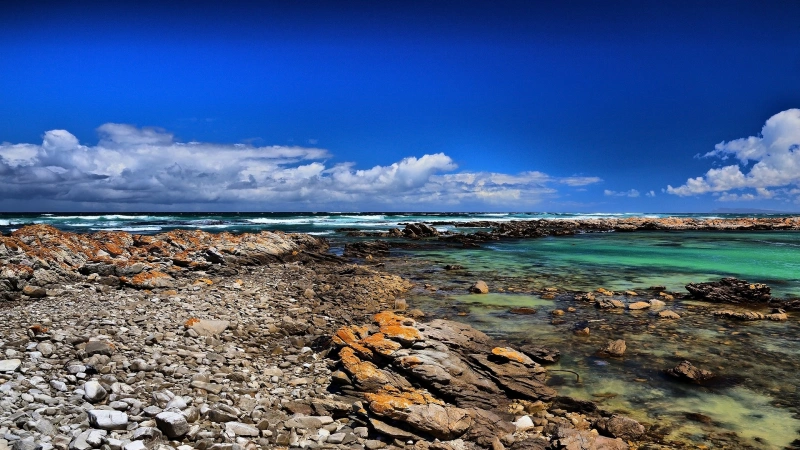
Southeast coast, South Africa
The Agulhas is one of the strongest western boundary currents on Earth — a 5-knot river in the ocean running down South Africa's east coast, with a rogue-wave history that has claimed ships for two centuries. Measured flow data here is not a science program: it is the input to every passage-planning decision on one of the world's busiest shipping corridors.
01 THE SETTING
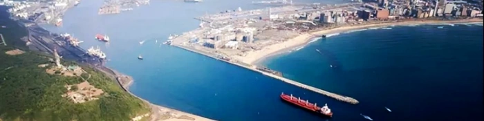
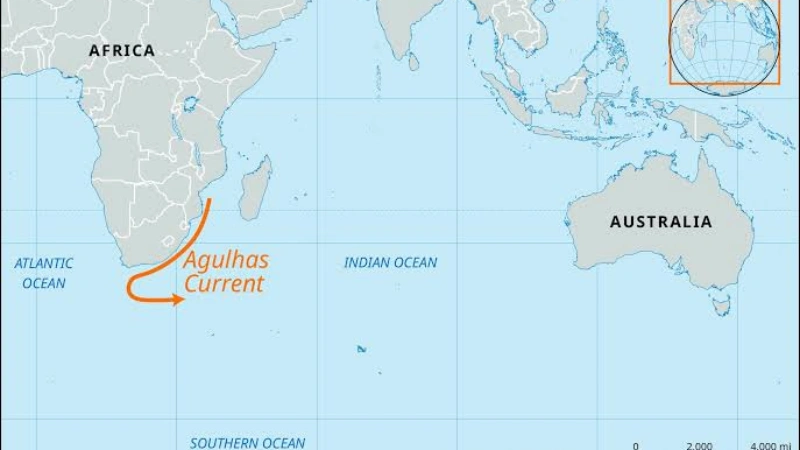
The Agulhas Current forms where the South Equatorial Current meets the African coast and turns south, flowing along the continental shelf edge from roughly 27°S to 40°S before retroflecting south of the continent. It runs parallel to the Durban–Port Elizabeth–Cape Town corridor, within 40–50 nautical miles of the coast — precisely where coastal shipping concentrates.
The current's significance to port operations is direct, and the Wild Coast leg between Durban and East London — about 250 nautical miles — has no ports or anchorages: once committed, a vessel's current decision has no correction point.
02 WHAT THE DATA SHOW
- The core — peak speeds reach up to 2.6 m/s (~5 knots), with averages around 1.5 m/s seaward of the 50 m depth contour; the core strengthens southward of Durban, sitting close to the shelf break (~2,000 m contour).
- The counter-current — inshore of the main flow, a weak northeastward counter-current (up to ~0.5 m/s) hugs the coast — small in magnitude but decisive for routing.
- Meanders and eddies — the current meanders and sheds eddies (Agulhas rings) into the South Atlantic; its inshore edge can move tens of kilometers in days, so where the current is today is a measurement problem, not a chart problem.
- AIS-measured ground truth — recent research reconstructs surface velocities of up to 2 m/s directly from merchant-ship AIS data — turning the world's shipping traffic into a moving current-measurement network.
03 WHERE CURRENTS THREATEN OPERATIONS
Routing economics
Southwestbound vessels riding the core average 10–12 knots over the ground with the current's assistance; northeastbound vessels hugging the counter-current save the equivalent in reverse — the difference between schedule and penalty.
Wild Coast exposure
With 250 nautical miles between ports of refuge, a misjudged current window cannot be corrected ashore — every routing decision on this leg is final until East London.
Wind-against-current & rogue waves
Southwest swell against the southwest flow steepens waves into the region's documented rogue regime (historically to ~30 m), worst in winter and whenever winds exceed 18 knots against the current.
Port approach & coastal ops
Ports along the corridor — Durban, Port Elizabeth, East London — sit between the core and the counter-current; approach planning depends on knowing which regime the vessel is in and where the boundary sits.
04 MEASUREMENT STRATEGY BY LAYER
| Layer | Challenge | Approach |
|---|---|---|
| Vessel transits (surface–160 m) | Core position and strength change daily | Vessel-mounted ADCP on scheduled corridor voyages — the highest-value, lowest-cost layer |
| Deep structure (to 650 m) | The current reaches several hundred meters; surface data cannot show its deep reach | 75 kHz moorings resolving full-depth structure and meander variability |
| Real-time surface layer | Live core-edge positions for routing services | Compact profilers in buoy wells streaming data to shore |
| Fleet sensing (surface) | Coverage without infrastructure | AIS-derived currents — merchant traffic itself becomes the sensor network |
05 THE OCEANTEK SOLUTION
Three instrument classes cover the corridor: continuous vessel profiling, deep moorings for structure, and buoy telemetry for the live core edge.
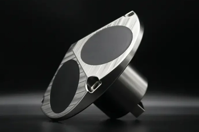
Ocean-ADCP-300-FA4
Ocean ADCP · 300 kHz- 160 m profiling range
- ±20 m/s velocity range
- ≤10 W · vessel-mount or mooring
- 1–8 m cells
Role: continuous profiling on corridor voyages — direct measurement of core position and strength, day after day.
View product →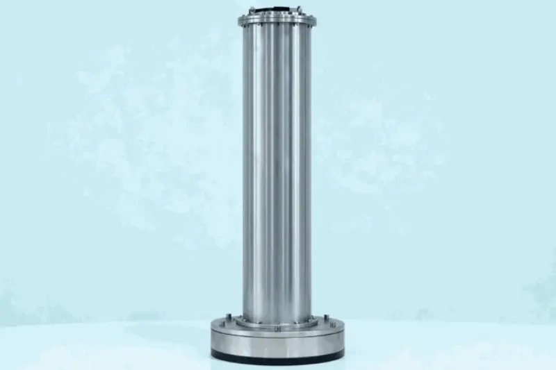
Ocean-ADCP-75-PA4
Ocean ADCP · 75 kHz- 550/650 m profiling range
- Bottom-track to 1000 m
- Titanium to 6000 m
- ≤20 W · long endurance
Role: moorings resolving the current's deep reach and meander/eddy variability that surface data cannot show.
View product →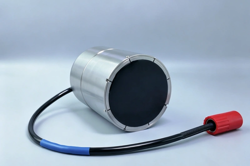
Ocean-ADCP-600-PA5
Ocean ADCP · 600 kHz phased array- 70 m profiling range
- 1.8 kg · ≤5 W
- ±20 m/s velocity range
- Titanium to 6000 m
Role: buoy-well telemetry feeding routing services with live core-edge positions in real time.
View product →06 FIELD NOTES
- Exploit the scheduled fleet — corridor vessels transit weekly; a vessel-mounted profiler turns every voyage into a current survey at near-zero marginal cost.
- Detect the counter-current deliberately — the inshore flow is weak (≤0.5 m/s) and sits in shallow water; profiling near the coast needs instruments that keep accuracy at low speeds and shallow depths.
- Account for wind boost — winds blowing with the current can add 1–2 knots temporarily; routing data should flag the wind-adjusted core, not the calm-water one.
- Treat winter as the exit criterion — published guidance says to leave the core when winds oppose it at 18+ knots; any operational current feed must make that call automatable.
🎯 Measuring a Boundary Current or Routing Corridor?
Vessel profiling, deep moorings and real-time buoy feeds — one instrument family covers the whole corridor.
🔍 Explore Ocean ADCP SeriesQuestions? Contact our technical team