Coral South FLNG, Mozambique Channel
Area 4, offshore Mozambique
The Mozambique Channel is one of the most energetic, least instrumented deepwater regions on Earth — and it is where Africa's first deepwater floating LNG plant now operates. Eddy-driven currents over 2,000 m of water set the rules for every mooring, offloading and inspection decision the facility makes.
01 THE SETTING
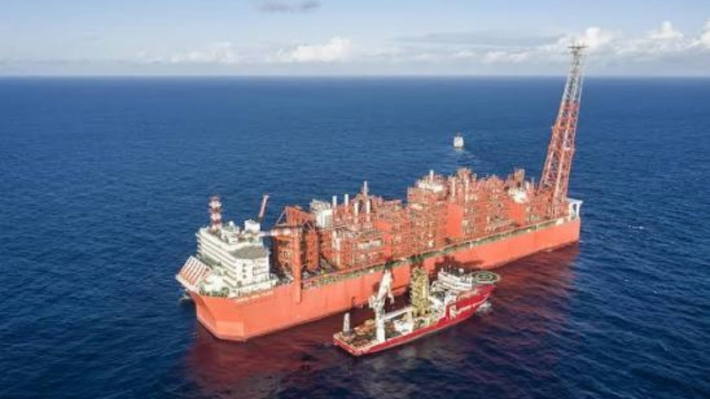
Coral South is ENI's flagship Mozambique project: a 3.4 mtpa floating LNG facility, built in South Korea and towed to Area 4 in the Rovuma Basin, turret-moored in water 1,500–2,300 m deep. The site sits at the edge of an unusually narrow continental shelf — 2 to 10 km wide, cut by submarine canyons, dropping to 2,000 m within about 40 km of the coast. Semi-diurnal tides along this coast range from 2 to 6.5 m, and the predominant swell arrives from the northeast in austral summer and from the south/east in autumn and winter.
The subsurface challenge is the oceanography. The channel between Mozambique and Madagascar is the main conduit of the Indian Ocean's western boundary system — and its flow field is anything but steady.
02 WHAT THE DATA SHOW
Published oceanography of the channel describes a flow field built from four interacting elements:
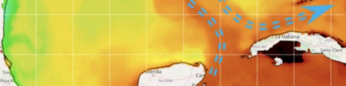
- The eddy train — the westward South Equatorial Current splits at Madagascar; the southward branch flows through the channel as a series of anticyclonic eddies roughly 300 km in diameter that extend deep into the water column and migrate southward. At any fixed point, the current reverses direction on eddy timescales.
- The East African Coast Current (148–185 km wide) joins the coast near Cabo Delgado, close to the FLNG's latitude, adding a persistent northward boundary flow.
- Mesoscale linkage — eddies leaving the channel's southern exit are implicated in triggering Agulhas meanders that shed rings into the South Atlantic — a pathway of global overturning circulation.
- Measured values at Area 4 — project metocean studies (2013/2014) recorded dominant surface directions of 210–240° and monthly mean speeds between 0.19 m/s (October) and 0.61 m/s (May). The means are modest; the variability is the hazard.
03 WHERE CURRENTS THREATEN OPERATIONS
Mooring system loading
Eddy passages and current reversals redistribute loads across the 20-leg turret mooring; without current profiles, load anomalies cannot be attributed to flow events and design margins cannot be verified against reality.
Offloading & marine operations
LNG carrier berthing alongside, crew transfers and intervention work all depend on knowing what the current is doing through the column — not just at the surface, where eddies can push a vessel contrary to the deeper flow.
Environmental baseline & spill response
The project's baseline program collected years of oceanographic data before first gas. In any discharge event, current profiles are the input to drift forecasts — the difference between a contained response and a wide-area one.
Subsea integrity & inspection
Mooring legs, flowlines and subsea structures at 2,000 m are inspected by AUVs whose navigation depends on bottom-tracking velocity — in a current field strong enough to sweep drifters out of the channel.
04 MEASUREMENT STRATEGY BY LAYER
The channel's measurement history is a textbook case of instrument selection under difficult conditions. Because surface drifters, floats and gliders are quickly swept out of the channel, the reference dataset is a moored array — under the Dutch LOCO program, scientists maintained an extensive ADCP array from 2003 to 2012, using 75 kHz-class instruments atop mooring lines and near the seabed. That decade-long record established the eddy train as the dominant transport mechanism — a result unattainable by any snapshot survey.
| Layer | Challenge | Approach |
|---|---|---|
| Deep moorings (full column, 2,000 m) | Eddy flows extending deep; long endurance | 75 kHz profiling ADCPs on seabed frames and mooring lines — the LOCO geometry, proven over a decade |
| Upper layer (top 160 m) | Offloading and marine-operation currents | 300 kHz high-resolution profiler resolving 1–8 m cells where operations live |
| Subsea & survey | Inspection navigation without surface reference | DVL-equipped AUVs navigating by bottom tracking along mooring legs and pipelines |
The published configuration and the scientific array point to the same conclusion: deep-reaching profile instruments on long-endurance moorings, upper-layer high-resolution records, and mobile platforms for inspection.
05 THE OCEANTEK SOLUTION
Oceantek's deepwater lineup covers the full Coral-South-type measurement chain — from 650 m profiling moorings to AUV navigation.
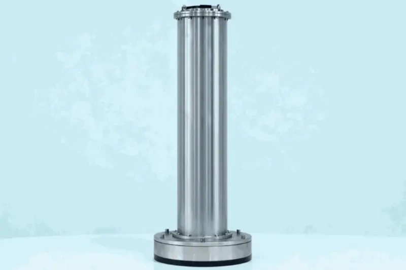
Ocean-ADCP-75-PA4
Ocean ADCP · 75 kHz- 550/650 m profiling range
- Bottom-track to 1000 m
- Titanium · 1500/3000/6000 m
- ≤20 W · self-contained ≥100 days
Role: the core mooring instrument — resolves eddy flows through the entire upper ocean from a single frame, with endurance for multi-month autonomous deployments.
View product →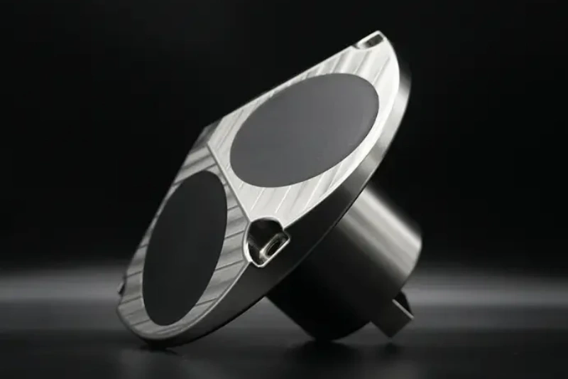
Ocean-ADCP-300-FA4
Ocean ADCP · 300 kHz- 160 m profiling range
- 1–8 m cells
- ±20 m/s velocity range
- ≤10 W · PD0 output
Role: outer-bay and approach-channel transects; seasonal moorings in 50–200 m; calibration data for hydrodynamic models of the bay.
View product →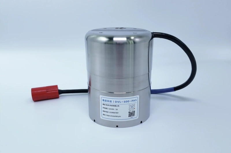
DVL-600-PA5 / DVL-300-FA4
Doppler Velocity Log- Bottom-tracking velocity
- AUV / ROV payload
- 600 kHz or 300 kHz options
Role: navigation for AUVs inspecting mooring legs, flowlines and subsea structures at depth — where no surface reference exists.
View product →06 FIELD NOTES
- Plan for eddy events, not averages — a deployment window may contain one eddy passage or several; size battery and storage for the longest plausible interval, with external packs extending to multi-year records.
- Titanium is the default, not an option — deep, warm, bio-active water at a permanently moored facility makes housing integrity a maintenance driver; the Oceantek deepwater lineup needs no sacrificial anodes.
- Match frequency to the layers that matter — 75 kHz buys reach (650 m); 300 kHz buys resolution where operations happen. The two-instrument pairing is the standard deepwater pattern.
- Keep an acoustic path open for telemetry — self-contained instruments collect for months between recoveries; direct-reading configurations over cable give operators eddy warnings before they show up in mooring loads.
🎯 Deepwater Current Monitoring for Offshore Energy?
From 650 m profiling moorings to DVL-navigated AUV inspections, the Oceantek lineup covers the full deepwater measurement chain.
🔍 Explore Ocean ADCP SeriesAlso see: DVL Series · Questions? Contact our technical team