Yangshan Deep-Water Port
Hangzhou Bay, Shanghai, China
Few ports in the world operate inside a stronger tidal current field than Yangshan Deep-Water Port. Built on reclaimed islands 32 km offshore in Shanghai's Hangzhou Bay, the port hosts the world's largest automated container terminal — and does so inside a macrotidal bay where modeled flood currents reach 2.88 m/s at narrow entrances and near-bed sediment concentrations exceed 3 kg/m³.
01 THE SETTING
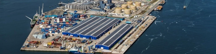
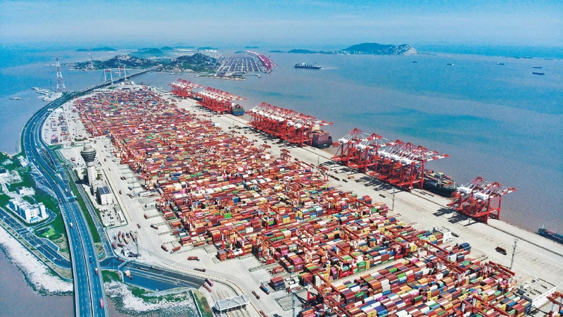
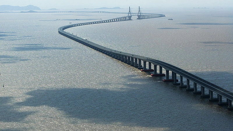
Yangshan occupies the Qiqu Archipelago on the north side of Hangzhou Bay, linked to Shanghai by the 32 km Donghai Bridge. Construction began in 2002 with large-scale reclamation, using dredged sediments as fill across several expansion phases. The Phase IV terminal (operating since December 2017) is the world's largest fully automated container terminal — 2.23 million m² of yard, a 2,350 m wharf and seven deep-water berths — and the port moves 20+ million TEU a year as the deep-water core of the world's busiest container port complex.
Hangzhou Bay is a macrotidal, funnel-shaped embayment — the same geometry that produces the famous Qiantang tidal bore at its head. Inside the sheltered 50 km² inner harbor, where the average wave height is just 0.47 m, it is the tidal current, not waves, that governs everything.
02 WHAT THE DATA SHOW
Public research on Yangshan's hydrodynamics documents a current field with strong spatial structure:
- Baseline flow — the average cyclic tidal flow across the port area is about 1.0 m/s, the major dynamic force in the region.
- Narrow-entrance amplification — high-resolution FVCOM simulations after construction show a peak surface flood speed of 2.88 m/s at the narrow tidal-channel entrance between Xiaoyan Reef and Dayangshan — the fastest point in the system.
- Open-water observations — fixed-site monitoring at the Hangzhou Bay mouth (September 2007) recorded maximum surface currents above 2 m/s.
- Flood–ebb asymmetry — west of the narrow entrance, flood runs faster than ebb; east of it, the pattern reverses. Vessel timing through the entrance changes with position, not just tide stage.
- Construction-induced change — damming of three inter-island passages redirected flow: spring-tide average flood and ebb currents decreased roughly 15% and 30% (30–40% at neaps) while currents in the remaining passages strengthened. Instrument siting based on pre-construction charts misrepresents today's flow field.
- Residual currents and siltation — residual flow averages ~0.11 m/s (up to 0.25 m/s at the surface, directed northwest). These residual currents, with the bay's high sediment supply, are the mechanism that continuously re-deposits sediment in the navigation channel — the direct driver of maintenance dredging.
03 WHERE CURRENTS THREATEN OPERATIONS
Navigation at narrow entrances
A 2.88 m/s cross-flow at a tidal entrance sets the maneuvering envelope for every 400 m ultra-large vessel, with circulation eddies at channel entrances adding local confusion — the reason the port runs a dedicated VTS and formal navigation-safety regulations.
Berthing windows & UKC
With 15+ m berths and basin currents above 1 m/s, approach timing and alongside speed are current-dependent, and a moored vessel's set and drift change with the flood–ebb asymmetry.
Siltation & maintenance dredging
Near-bed sediment concentrations average 0.89–0.95 kg/m³ and peak above 3 kg/m³; residual transport makes maintenance dredging permanent — and current data tells planners where the next deposition will occur.
Typhoons
The East China Sea is a major typhoon corridor. Storm-driven current surges can far exceed tidal norms — the reason instruments at a Yangshan-type port need ±20 m/s velocity headroom.
04 MEASUREMENT STRATEGY BY ZONE
The flow field above is not one problem but three, each needing its own measurement geometry:
| Port Zone | Dominant Challenge | Measurement Approach | Instrument Class |
|---|---|---|---|
| Narrow tidal entrance (Xiaoyan Reef–Dayangshan) | 2.88 m/s cross-flow, entrance eddies | Fixed horizontal profiling from channel wall or pier, real-time telemetry to VTS | Horizontal ADCP (side-looking) |
| Harbor basin & berth pockets (<20 m) | Berthing windows, siltation at berths | Bottom-mounted upward-looking moorings, self-contained long-term | 600 kHz ADCP |
| Outer bay & approach channel (20–70 m) | Flood–ebb asymmetry, model calibration | Vessel-mounted transects plus seasonal moorings | 300 kHz ADCP |
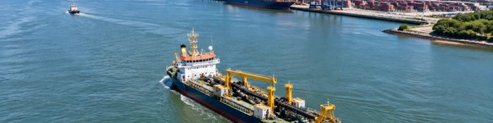
| Dredging works | Plume tracking, post-dredge verification | Repeated transects before/after campaigns, near-bed point stations | 300/600 kHz ADCP + point meters |
Two principles follow from the published science. First, monitor the residual current — it is the siltation driver, and only long time series reveal it. Second, re-baseline after every major construction phase — Yangshan's own history shows that damming inter-island passages shifted the entire velocity field.
05 THE OCEANTEK SOLUTION
Oceantek's ADCP portfolio maps directly onto the three-zone strategy. All instruments share a titanium housing, ±5 m/s default velocity range (extendable to ±20 m/s) and standard PD0 output.

HADCP-600-FA3
Horizontal ADCP · 600 kHz- 90 m horizontal range
- ±20 m/s velocity range
- 20 m depth rating, pier/wall mount
- 2 horizontal beams + 1 vertical
Role: real-time cross-flow and along-channel velocity at narrow entrances and turning basins, feeding VTS and pilotage; two-person installation on bridge piers or quay walls.
View product →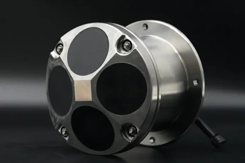
Ocean-ADCP-600-FA4
Ocean ADCP · 600 kHz- 70 m profiling range
- ±20 m/s, ±0.3% accuracy
- Titanium housing to 6000 m
- ≤10 W · self-contained ≥100 days
Role: bottom-mounted upward moorings in the harbor basin and berth pockets; dredging support surveys; high-resolution profiles in <50 m water.
View product →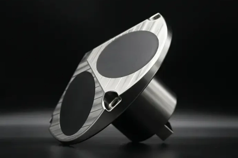
Ocean-ADCP-300-FA4
Ocean ADCP · 300 kHz- 160 m profiling range
- ±20 m/s, 1–8 m cells
- Vessel-mount or mooring
- ≤10 W · PD0 output
Role: outer-bay and approach-channel transects; seasonal moorings in 50–200 m; calibration data for hydrodynamic models of the bay.
View product →For a port the scale of Yangshan, the natural configuration is a three-tier network: HADCP-600 units fixed at entrance walls for real-time cross-flow, a grid of self-contained 600 kHz moorings inside the basin, and periodic 300 kHz vessel surveys covering the outer bay. Point current meters at dredging or outfall locations complete the picture where only single-depth, multi-month records are needed.
06 FIELD NOTES
- Plan range with margin — in water carrying 1–3 kg/m³ of sediment, effective acoustic range shrinks; site the instrument close to the critical lane and budget reduced profiling distance.
- Time deployments around dredge plumes — near-bed SSC peaks above 3 kg/m³ and plumes are denser still; schedule transects outside active dredging windows.
- Resolve the shear layers — smaller cell sizes (0.5–2 m) capture the entrance shear that matters for vessel handling; the ±20 m/s range absorbs the noise trade-off.
- Build for long, corrosive deployments — titanium housings with no sacrificial anodes reduce service burden on moorings visited only once or twice a year.
- Leave typhoon headroom — specifying ±20 m/s costs nothing at deployment and covers storm surges that tidal norms never predict.
Planning Current Monitoring at a Port ?
From fixed horizontal profiling at narrow entrances to long-term basin moorings, the Oceantek ADCP lineup is built for ports like Yangshan.
Explore Ocean ADCP SeriesAlso see: HADCP-600 Horizontal ADCP · Questions? Contact our technical team